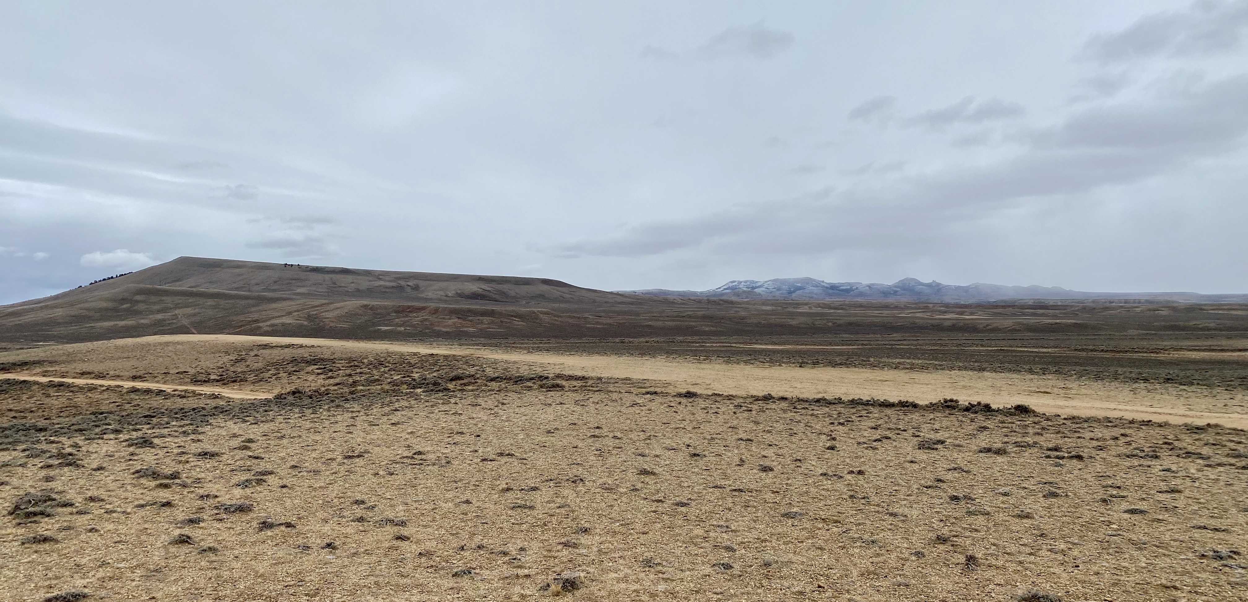
I had imagined this day as the climax of my Oregon Trail-in-reverse, the one on which I would cross the Continental Divide at South Pass, the 20-mile-wide flat in the Wyoming Rockies that trapper Robert Stuart “discovered” in 1812 and Jedidiah Smith “rediscovered” a decade later, when explorers began mapping routes to the Pacific. I felt raw, exposed, connected—with nature, the bitter weather, the vast emptiness, the past and present as one.
It’s an abstraction to read of characters and their adventures. It feels real to stand on the paths they trod, wagon ruts still visible. To do it on a cold, gray, blustery day with snow threatening and few other travelers on the road is overwhelming. My heart was in my throat as I drove off pavement onto muddy roads to see the spot where the Oregon Trail crosses the Divide (7,411 feet above sea level) in sight of the Twin Mounds; where in 1847 explorer Jim Bridger conferred with Brigham Young about routes to Salt Lake; where in 1846 the Donner Party broke south on a new route to California.
These names in my books—Bridger, Stuart, Young, Donner—blazed marks for generations that followed this trail. Explorers diverged for the sake of diversion. Some emigrants had the intuition and courage to try shortcuts unknown; others headed for new destinations. Their technology changed: walking to wagon, Pony Express to telegraph, railroad to highway. But the paths aren’t new; peoples have traveled them for 10,000 years.
I started out at dawn, in rain and wind, from a campsite next to the reservoir created by the 1958 damming of the Green River in Flaming Gorge (part of the water supply for Los Angeles). The water line is at 6,000 feet above the sea; the county road from the reservoir rises over 10 miles to 7,300 feet at US 191. Halfway up, the rain became snow, and once on the highway the lanes disappeared. (I explain that I suffer from driving-in-snow PTSD, thanks to a trip in April into the Blue Mountains, in which I got snowbound overnight. Nothing uncomfortable about that experience except the loss of control; I enjoyed the moment, but leaving my van marooned on a desolate road for 13 days was an experience I need not repeat.) I was grateful the snow this morning was no worse. Also grateful I wasn’t in a covered wagon, heading for parts unimagined.
Tonight I checked into a hotel, after a week of camping, on the Wind River Reservation, which holds the remnants of two recognized tribes, the Eastern Shoshone and the Northern Arapaho. Before the United States took their land, many tribes lived where the Great Basin, through which I just passed, meets the Great Plains that roll down to the Missouri River, 500 miles east. In 1868 Chief Washakie agreed to the Fort Bridger Treaty that ceded tribal lands; he remained committed to its terms for the rest of his life, even as the United States shrank the reservation further. The least I can do is support their hotel/casino (which upstairs is like a Hampton Inn but costs about half as much).
A few days ago, I stopped at Fort Bridger, named for the iconic Mountain Man who had earlier established a trading post on the site. There I felt the same awe I felt today, to be walking on Jim Bridger’s path. (Bridger married Washakie’s daughter.) Bridger, one of those former beaver trappers (noted in my pre-trip narrative) who made another life guiding emigrants west, preferred exploring to store-managing. The curator of the Wyoming state park that bears Bridger’s name told me that the trading post had two flag poles: one for the U.S. flag, the other, plain red, indicating Bridger was on grounds. The red one rarely flew.
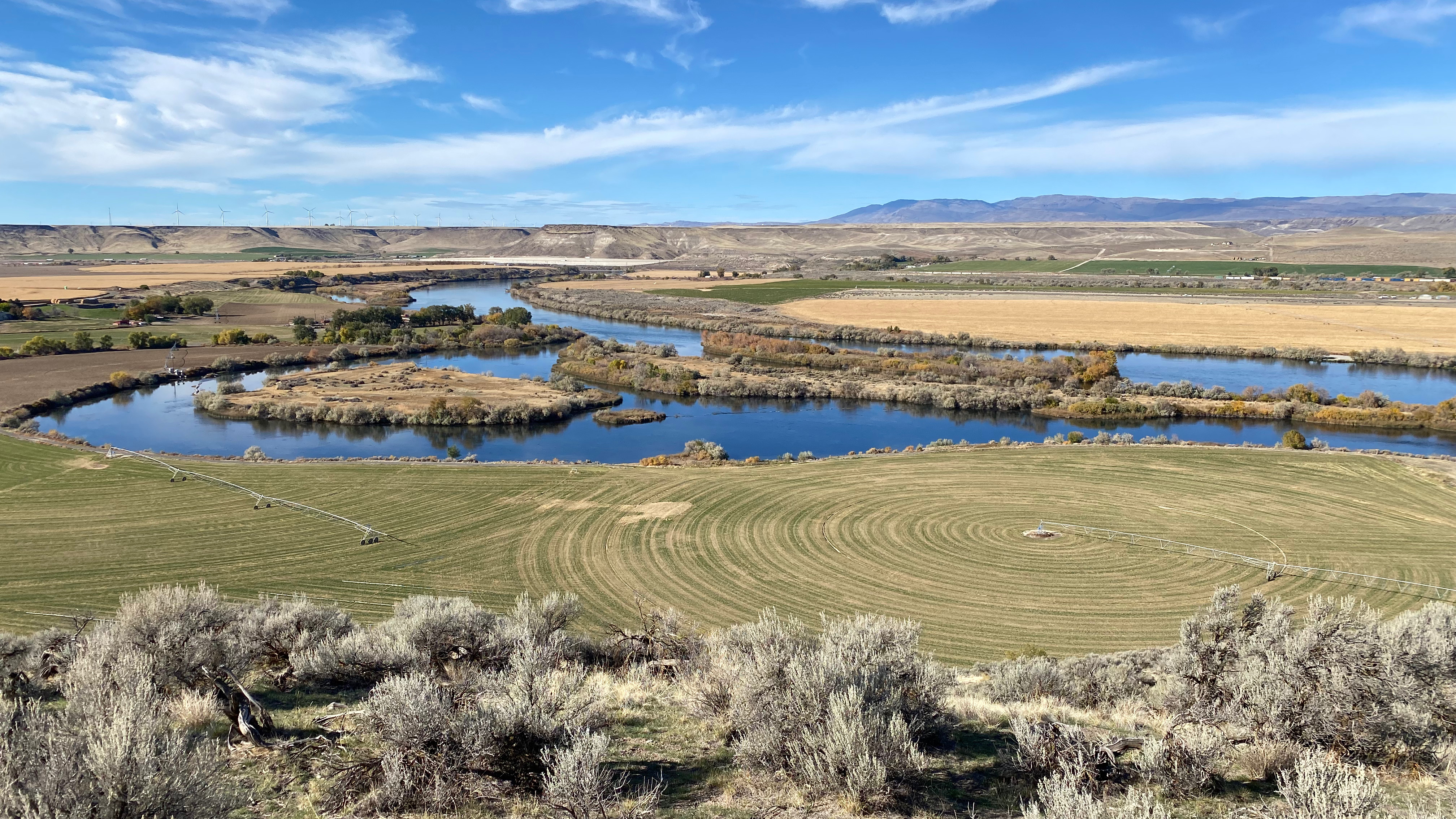
Weeks after the overlanders to Oregon stopped at Bridger’s store, they crossed—or didn’t—the Snake River east of what became Boise. I was there five days ago, traveling in the opposite direction. I’ll tell this chapter as I saw it.
Bonneville Point is a promontory east of the Boise Valley. Before the White Man came, it was an overlook on a tribal trail. In 1833, Army Captain Benjamin Bonneville led an expedition along the trail; upon reaching the hill and seeing the lush valley below, he is said to have exclaimed, Les bois! – “the woods!” Thus Boise was named.

From this hill I drove about 50 miles east over dirt roads that crossed and paralleled the route Bonneville and others sketched out for the American emigrants who would begin trekking a decade later. By the time I got to Glenns Ferry, a town built where the overlanders had floated their wagons to the north side of the Snake, I was toast. I had puttered along for about four hours, stopping to examine wagon ruts, stage stations and other ruins, and I was exhausted just thinking about crossing this desert on foot or in a wagon, focused on the distance to the next creek. I’ve had something like that feeling: One day on my bike, I rode a hundred miles on the Washington side of the Columbia; mostly I thought about my water supply, though fully aware I could stop at any farmstead for a refill. The overlanders lacked that option. And when I checked in at Three Island Crossing State Park in Glenns Ferry, I rinsed off the dust that coated my van inside and out and treated myself to a shower. The emigrants did not.
It’s on the opposite bank from Glenns Ferry that the overlanders had a difficult decision, having arrived there in August after four or five months walking the trail: continue on the longer, drier, rockier southern route to Fort Boise, or cross at the Three Islands to occasional streams and food for their stock. The crossing was dangerous, and it still is. A neighboring camper told me locals used to stage an annual reenactment of the river crossing a few hundred yards south of our park, but they gave it up after drowning too many mules and oxen.
Most of us have no clue of such hardships. But we could go talk to the people who make their way from Central America to the Rio Grande for insight into a contemporary example.
