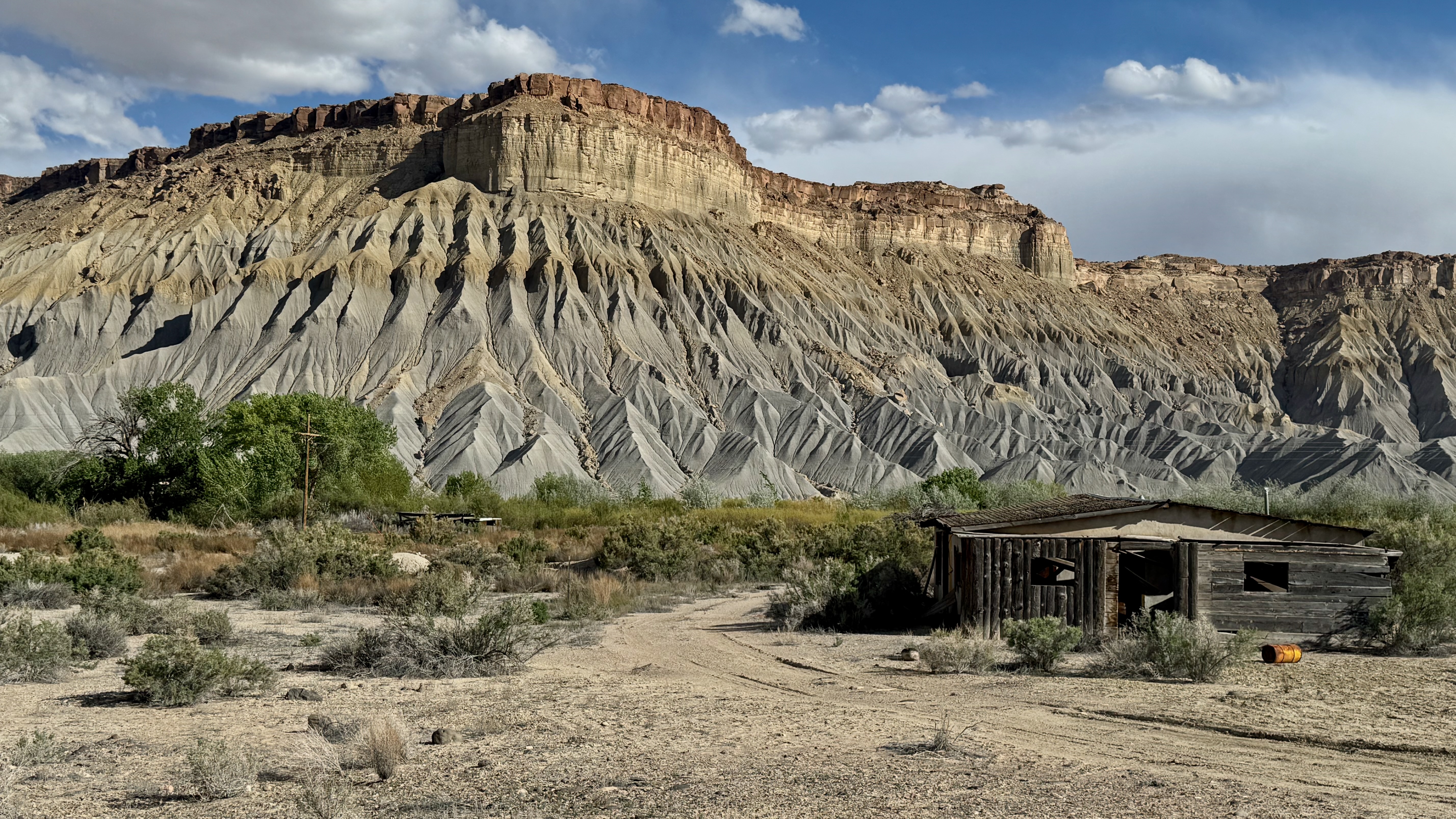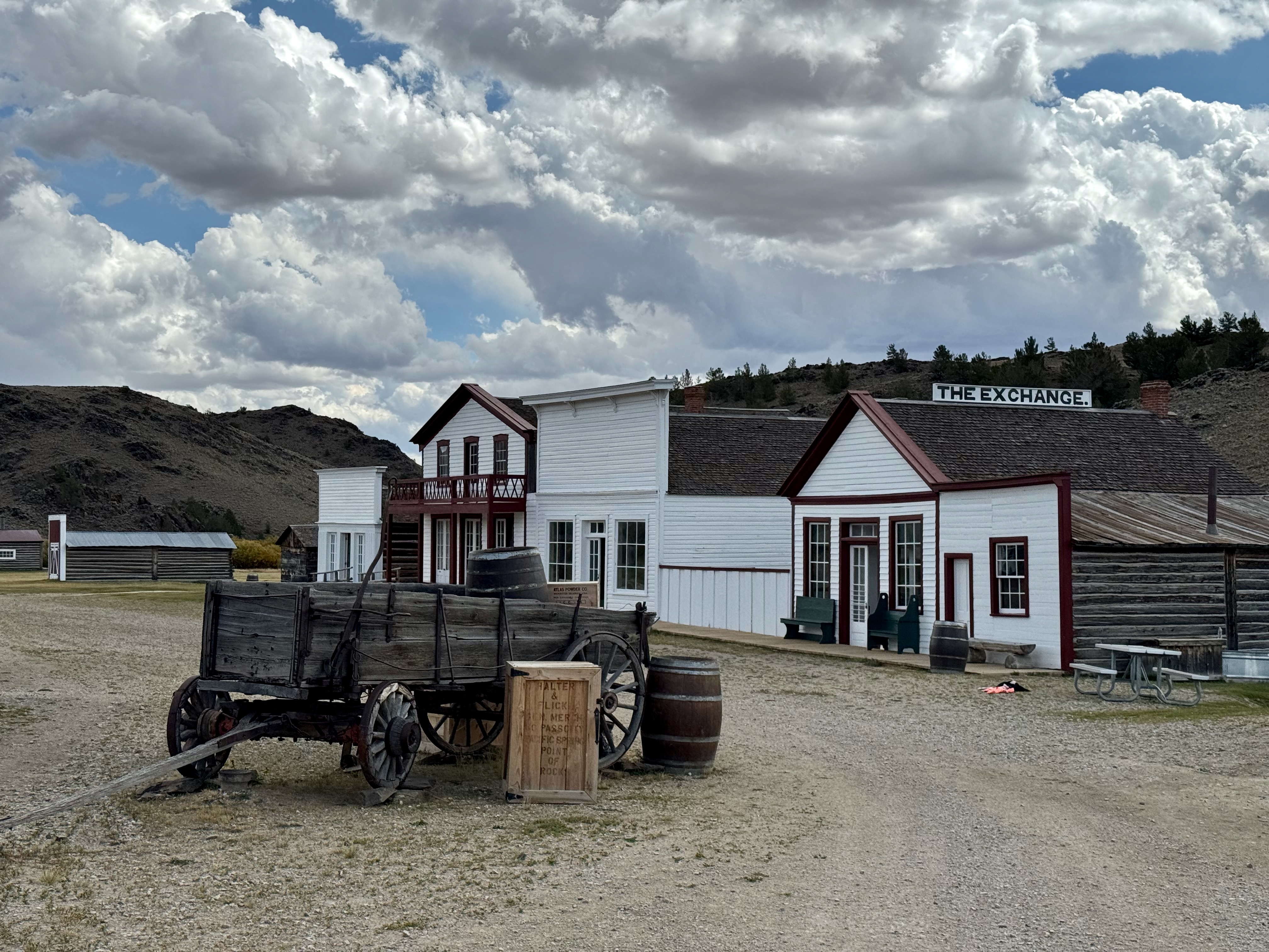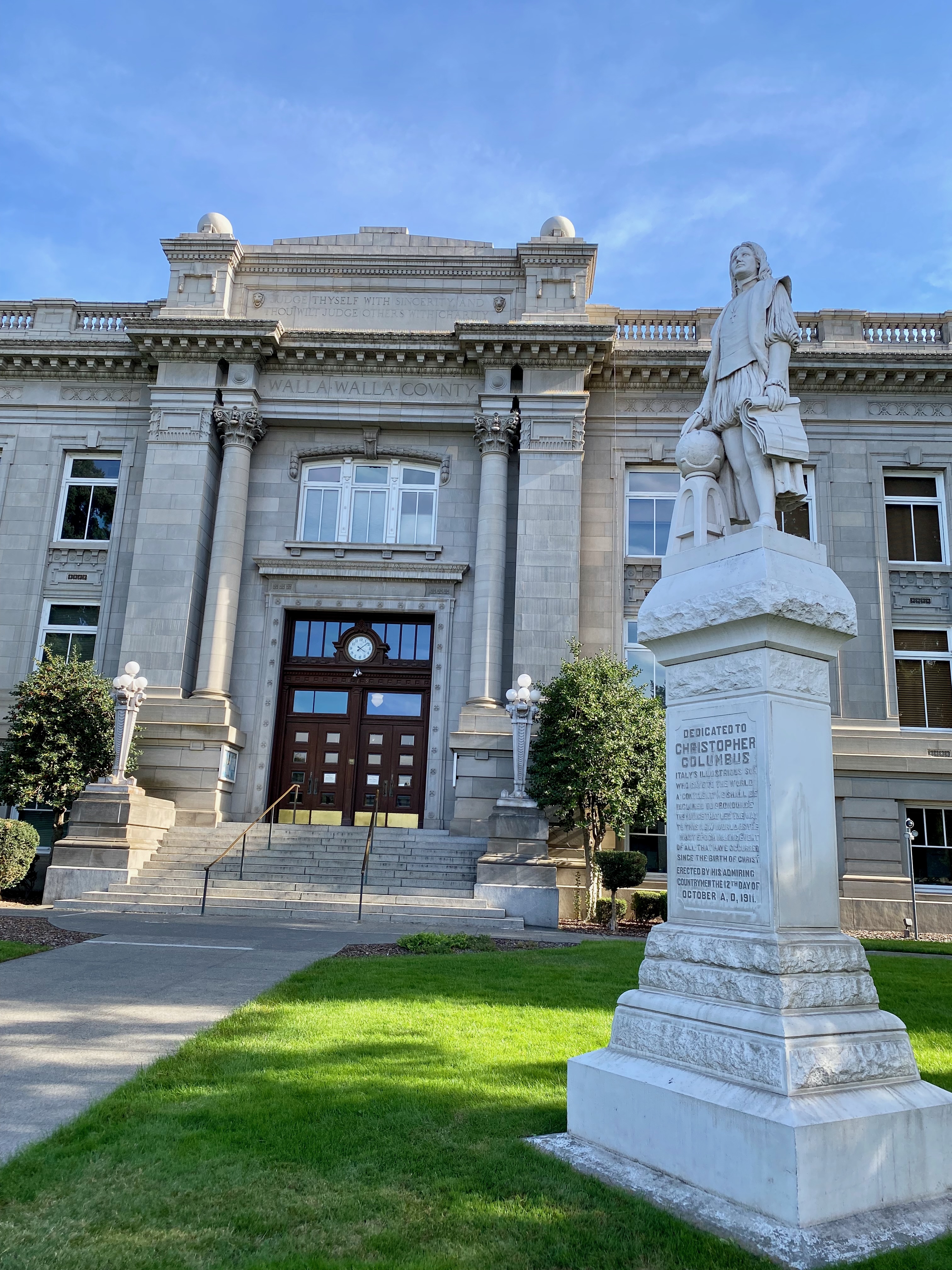
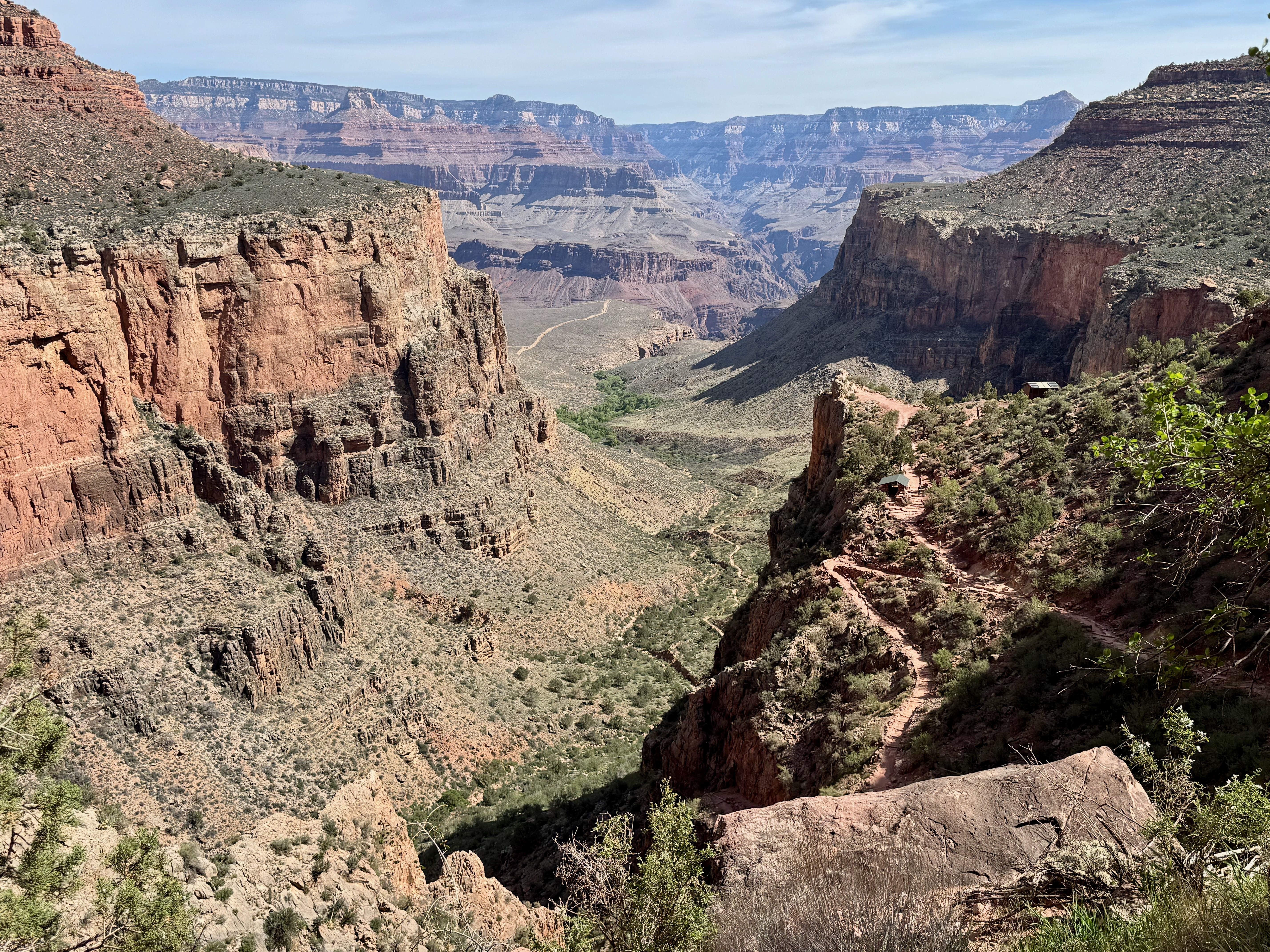
The exposed rock where the Colorado River runs through the Grand Canyon is 2 billion years old. The rim above the canyon—170 million years of accumulated sediment—blew away as dust. Eight centuries ago, the civilization that existed here left behind pottery shards. In its war of aggression 180 years ago, the United States seized the northern half of Mexico. Like everything else in the desert Southwest, ownership of the land and everything on it is temporary.
Gazing at my United States wall map, with highways I have recently traveled marked in pen strokes, I planned to return to the Colorado Basin, especially areas in southern Arizona and New Mexico that would be new to me. I came away having seen artifacts of many cultures that, for reasons we mostly guess, picked up about 1250 CE and went elsewhere. I am left to ponder the ephemeral identity “American.”
What follows are post cards of a 6,000-mile journey: a thousand miles south on the Pacific coast, winding circuit north of the Mexican border curling into Utah and Colorado, then northwest along antelope trails across Idaho toward home, up a hill from where the Willamette meets the Columbia. Most of the trip would traverse the “Four Corners,” arbitrary lines drawn on principles of the Northwest Ordinance of 1787. Designed by Thomas Jefferson and reinforced in the 1862 Homestead Act, the system imagines land as squares to be owned, without any notion of their topography. But that’s another story. This story is of a traveler driving a ribbon of asphalt, visiting spaces we have, for now, preserved. One hundred photos of it are on my flickr here.
A disproportionate share of our (mostly) undisturbed space is in what was Mexico until 1848. Why? First, because it’s public land, having been incorporated into the United States before settlers arrived. Second, because as emigrants and soldiers pushed and squeezed Native tribes after the war, people began perceiving the threats we posed to it: ranching, mining, tourism and theft. In lands with little rain, ranchers fouled watersheds. Under the 1872 Mining Law, prospectors staked claims for free. Timber companies stripped forests. Tourists carried off artifacts.
On paper, Yosemite in 1864 and Yellowstone in 1872 were designated for protection. Congress considered broader protections in the 1880s and passed the Forest Reserve Act in 1891, a precursor to the Antiquities Act of 1906. Which became the foundation of the national park system, formalized in the Organic Act of 1916.
The Antiquities Act was one of Theodore Roosevelt’s big sticks. In the final three years of his presidency, he designated millions of square miles of wildlife refuges, national forests and monuments, many of which Congress later codified. One of his most controversial acts was to protect 800,000 acres of the Grand Canyon over the objections of ranchers, miners and railroads. Congress made it a park in 1919, and in 1975 Gerald Ford signed a bill to increase it to 1.2 million acres. Over the decades the conservation movement has grown adherents, with presidents more or less supportive. Until Donald Trump.
In Trump’s first term, Congress repealed protections for bear and wolf families in Alaska refuges, and the Interior Department repealed a ban on lead ammunition in wildlife refuges. (Hard to understand how ammunition is allowed in a “refuge.”) The assault has continued in his second. Thousands of Park Service and Forest Service positions have been eliminated, though exact numbers are hard to find (so much of the federal bureaucracy is gone). Attacks on the environment have been prolific and specific. For example, a federal court has paused the Bureau of Land Management’s plan to harvest old-growth trees on 2400 acres in southwest Oregon. BLM policy prohibits logging trees greater than 40 inches in diameter or older than 175 years; a coalition of environmental groups demonstrated that the government had ignored it. (The “Blue and Gold” harvest plan began under the Biden administration.) This year Congress nullified a Biden order that had protected 226,000 acres from mining in the Boundary Waters of Minnesota, a refuge for wildlife and recreation.
In the Southwest, I was anxious to visit and revisit preserved areas before our government destroys them. To get there, I would stick to my practice: drive no more than 200 miles a day, starting from Portland. Besides, the Pacific coast is a joy.
I have driven US-101 and California-1 both directions. The entire coast, from the Juan de Fuca Straight to San Diego, is filled with contrast. From the mouth of the Columbia to the Lost Angeles basin, the tide crashes against mountains. Oregon Dunes National Recreation Area, created by Congress in 1972, includes piles of sand 500 feet high along a 40-mile stretch of the coast. Sand, pine, wetlands, campgrounds—hardly a village between Florence and Coos Bay.

Fifty miles south of San Francisco, I stopped at the Pigeon Point Lighthouse. Alexander Hamilton’s Treasury Department established the bureau that began building lighthouses; now it’s under the Commerce Department. Pigeon Point is named for the clipper Carrier Pigeon, which wrecked in the fog in 1853. After three more shipwrecks, the Lighthouse Service built the 115-foot lookout here in 1872. The lighthouse is being renovated; its 1,008 prisms have been reassembled in a museum at ground level. The docent who told me about it volunteers there three days a week, and others with a fascination fill the duty at the state park whose foundation is restoring the light. A hostel occupies several buildings of the original lighthouse complex.
On to Santa Monica. My goal was full days at my favorite L.A. museums: the Getty Center and the Getty Villa, 10 miles apart. Both are astonishing in their design, scholarship and staffing. J. Paul Getty, oil man and industrialist, spent decades collecting art, and the Getty Trust, with more than a half-billion dollars in annual revenue, is dynamic in its public presentation, regularly rethinking its buildings, galleries and collections. (Next year the Center, in Brentwood, will close for a year-long, $600 million renovation.) Here’s something of my experience at the Center.
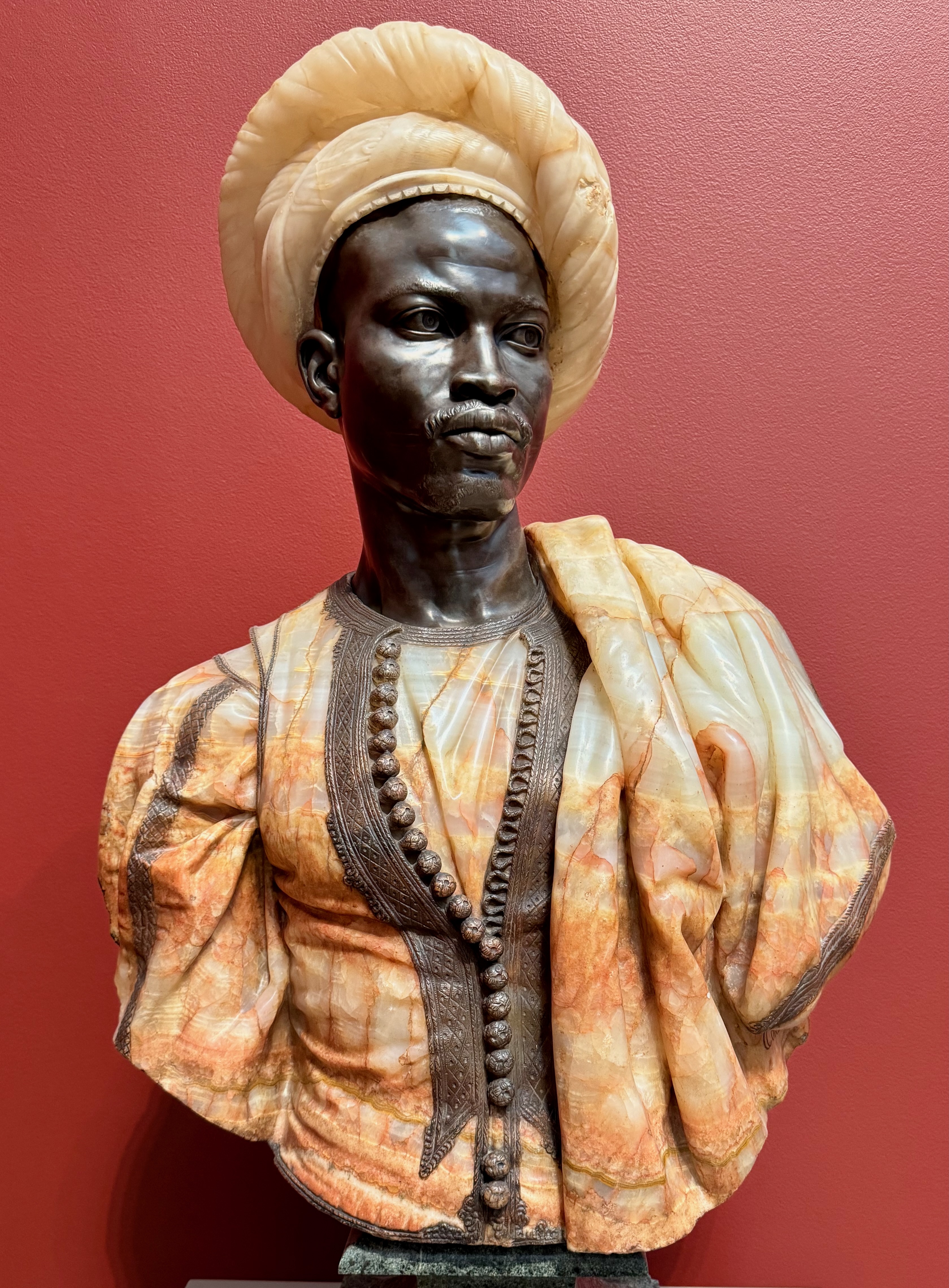
I biked there, so I didn’t pay for parking; admission is free. A tram runs from the parking garage to the campus. Greeters welcomed me every couple hundred feet. I took two guided tours, each about 45 minutes. In one gallery, the docent explained that the French Empire furniture was about to be shuffled to reflect a revised interpretation. In another, he asked us which paintings most interested us; we focused on an early Rembrandt. At lunch the entire menu was appetizing. Then on to a temporary exhibit on the Guerilla Girls, an anonymous group of women in gorilla masks who since the 1980s have run publicity campaigns targeting the sexism of cultural institutions. After five hours wandering through four buildings, I walked through the terraced gardens, a respite after all that art.
Two days later I spent another six hours at the Getty Villa, a recreation of the Villa of the Papyri, owned by Julius Caesar’s father-in-law. Located on the Bay of Naples at Herculaneum, the original Villa was buried when Vesuvius erupted in 79. In 1750 well diggers discovered it, and archeologists uncovered its library of 1,785 carbonized papyrus scrolls. Getty decided to build a replica to house his collection of ancient Western art. He’d lived in England for decades and died without seeing the finished project, opened in 1974.
Whereas the Getty Center is a complex of buildings and grounds housing a world-spanning collection, the Villa is an intimate space, its design in harmony with small rooms of Egyptian, Greek and Roman sculptures. My favorite element is the intricate tile work. I could live here, gazing out at the gardens and how they fit into a pie-shaped hillside above the Pacific. As I was leaving I told a guard how grateful I was to visit and didn’t want to go. Yes, she smiled, it’s different. No, I said, it feels like home.
On day 11, I left the coast at Laguna Beach and drove over the winding road through Cleveland National Forest, protected by several presidents responding to local demands for restoration of watersheds in the Santa Ana Mountains. Mining, timber-cutting and overgrazing had degraded this swath off the coast. The Forest Reserve Act, which Benjamin Harrison signed, was a milestone in the environmental movement, allowing the president to regulate harvesting in designated tracts. Harrison and then Grover Cleveland created several reserves in the region before Roosevelt combined and expanded them to an area nearly 56 miles square. (Later presidents shrank the forest by four-fifths.) The climax of the drive on California-74 is the 1200-foot drop on the east side of Lake Elsinore on sharp switchbacks.
Lake Elsinore, originally a natural lake, marks the edge of the desert. I had planned this trip for early spring to avoid the blast furnace that descends on the Southwest. This first day it was 100 degrees, dampening my enthusiasm for hiking. The heatwave would last more than two weeks, melting most of the winter’s meager snow pack in the Rockies.
The Anza-Borrago Desert is the largest state park in California, covering a fifth of San Diego County. Driving the Great Overland Stage Route, aka S-2, I came across a road sign outlining the “San Antonio and San Diego Mail Line,” founded by government contractor James Birch in 1857. Birch hauled mail and passengers by mule train. “Guard and passengers carried rifles and pistols. Most stops along the route were nothing more than outdoor camps. Vallecito Stage Station was different. As a home station, it offered meals and a place to sleep on the dirt floor.” Again from the road sign: The 1,500-mile route was hailed by the San Diego Herald as “an epoch in the Pacific Coast of the Union, which will be recorded and remembered with just pride.” Save for the sign and some historians, it’s forgotten.
The first run left San Antonio that July 9, 1857, and arrived in San Diego August 31. Birch, meanwhile, sailed from San Francisco toward Panama, intending to be in Washington for the award of another postal contract. But the steamer Central America, departing from the east side of the isthmus, sank in a hurricane off Cape Hatteras on September 12. Birch was among 425 passengers who perished, the worst maritime disaster in American history. (Postscripts: The town of Herndon, Virginia, once a stop on a short-line railroad between Alexandria and the Blue Ridge foothills, now a suburb next to Dulles Airport, was named for the Central America’s captain, William Herndon; $150 million in gold was recovered from the ship’s wreckage in 1988.)
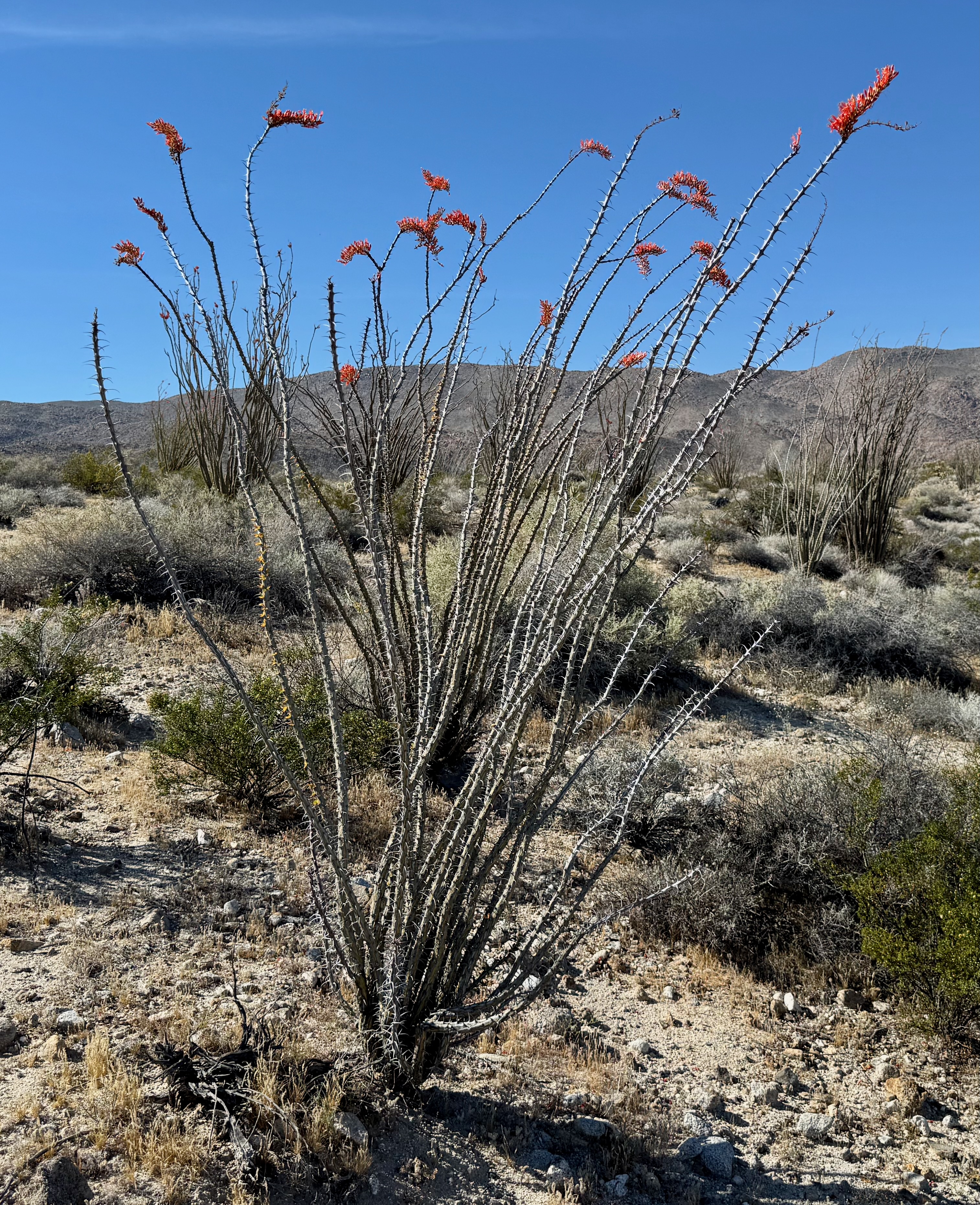
S-2 terminates at Ocotillo, California, on I-8. Soon I was in the Imperial Valley, the final U.S. sponge for the Colorado River. Canals run parallel to the highway, turning desert into shades of green: alfalfa fields (the first link in our insatiable demand for hamburger) and all manner of leafy veggies we buy in salad kits or stacked on industrial coolers. Between November and March, 90 percent of the leafy greens in our grocery stores come from here. A road sign near El Centro read “Burn a bale, go to jail,” a joint effort of the farm bureau and sheriff’s department targeting arsonists who light haystacks. (I thought “bale” a clever play on “bail.”)
Climate change threatens this vegetable basket. How scarce water will be apportioned in the Imperial Valley compared to dam-driven power for Las Vegas and Phoenix is yet to be determined, but it is a crisis coming to your grocery store.
On the south side of the interstate is a network of port-a-potties for Border Patrol agents in idling Suburbans, 200 yards from our Maginot Fence. I drove through several deserted check points, their metal awnings spanning the highway. In coming days I would drive along Trump’s wall across New Mexico to El Paso. More empty check points, a dirigible on a wire 200 feet in the air, cameras on sticks pointed south, the occasional Suburban parked on a dirt path. The Department of Homeland Security is the second-largest army in the U.S.
On the flank of Arizona is the northern boundary of the organ pipe cactus. Organ Pipe National Monument runs 25 miles of the Arizona-Mexico border. The visitor center is 20 miles south of Ajo, a town of 3,000 people next to a shuttered open-pit copper mine. Considering the emptying out of rural America, I wondered how a company town, 40 years from the end of its glory days, still has a picturesque plaza with a great coffee shop (double shot for $1.59), a grand hotel and houses that appear fairly maintained.
Bo, the manager of the visitor center, offered many reasons. Bo was born and lived here till he was 10, followed his dad to Dallas, returned for high school and later moved back where both sets of grandparents still live. The mine is closed, but Organ Pipe’s rangers are headquartered down the road. The Border Patrol station, a bit closer, has 500 employees. The town has about 3,000 residents. Ajo is on the drive from Phoenix to Puerto Peñasco, a hundred miles south on the Gulf of California. A million vehicles pass through Ajo annually.
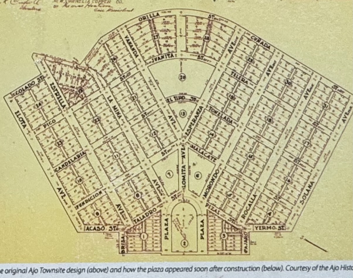
I’ve not seen a company town so pleasingly designed as was the vision of John Campbell Greenway, a Yale-trained engineer, Theodore Roosevelt Rough Rider and manager of New Cornelia Mine. His 1917 master plan fans away from the plaza up the east side of a mountain. The copper mine is to the south, and the tailings and containment ponds—about twice the size of the town—trail off on the east. Greenway’s former home sits on the south side of the mountain facing the pit. “Housing was segregated by ethnicity and status. Anglos who oversaw mine operations were offered numerous styles and locations of homes, while Mexican laborers were offered a single choice within the ‘Mexican Townsite.’ Native American mine workers were left to find their own housing outside the town center.” The Ajo Historical Society reports that despite segregation, everyone mixed at the plaza. (And no doubt in the mine.)
Ajo is unincorporated, has no town council or mayor. “Everybody just comes together and gets stuff done,” Bo said. The chamber of commerce, for whom Bo works, is the organizing agent, and Freeport-McMoRan, successor to New Cornelia and one of the universe’s largest mining companies, writes a check for Santa’s annual sleigh ride. Freeport is still here because it expects the progression of extraction technology to make short-term expenses worthwhile.
In the gift shop at Organ Pipe, Maria the manager said she moved from Wisconsin to Ajo after her daughter held her wedding there. “I thought, this is a nice place.” How do you deal with the heat? “Get up early, move slowly, find shade or air conditioning. I’ve come to like it.”
After the Mexican American War, the two nations settled the southern border of Arizona/New Mexico in 1853 with the Gadsden Purchase for $10 million. Mining and ranching began soon after and continued into the 1970s within Organ Pipe, which Franklin Roosevelt proclaimed a monument in 1937. The U.N. declared it an “international biosphere reserve” in 1976, and Congress promptly designated 95 percent of it wilderness.
That hasn’t stopped a string of presidents from trampling the monument with border infrastructure. The Trump administration destroyed sacred sites of the Tohono Oʼodham Nation when it built the wall across the monument in 2020. The federal government has pushed the Tohono O’odham around southern Arizona since 1874. Today the largest of its four non-contiguous reservations covers an area along the border between Organ Pipe and Tucson.
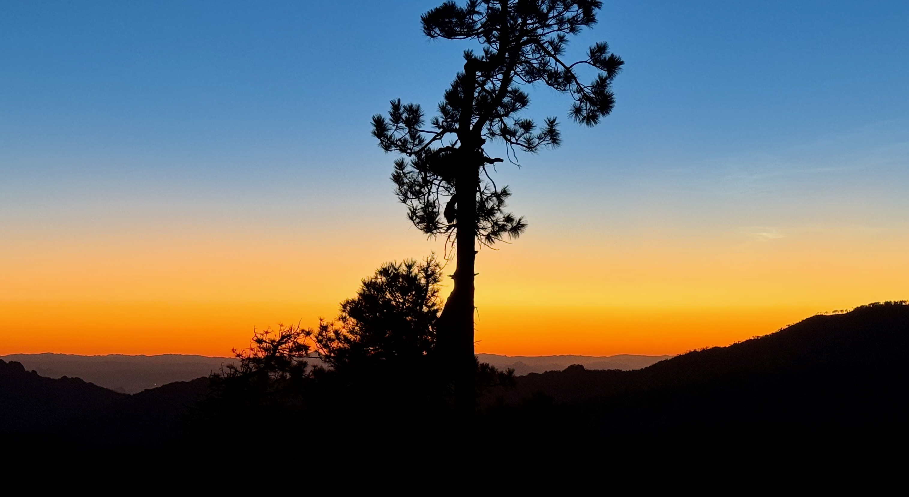
In Tucson the March weather slammed me. Acclimated to western Oregon’s rainy chill, I found walking around Tucson at just under 100 degrees challenging. The day after strolling Old Tucson and the University of Arizona, I drove up Mount Lemmon, part of the Santa Catalina Mountains of the Coronado National Forest, overlooking Tucson’s sprawl from the north, and camped at 8500 feet. By 3 p.m. I had donned four layers and a knit cap and fallen asleep from oxygen deprivation. Off a dirt road the Forest Service has designated for dispersed camping: silence. We have exterminated the predator fauna. I heard a few birds and a few airplanes as the sun made its way over the horizon.
South of Mount Lemmon lies the eastern section of Saguaro National Park. Lush is not a word I associate with the desert, but in March it fits this one. The variety of blooming cacti and other plants rivals any botanical garden.
Like many parks, Saguaro is the result of local effort. The University of Arizona, the Tucson business community and influential Republicans pushed Herbert Hoover, a former head of the National Parks Conservation Association, to create the monument three days before he left the presidency. Franklin Roosevelt’s Civilian Conservation Corps built the infrastructure. In 1994 Congress established the park, which is two vast sections east and west of Tucson, the city running to their edges. Little of it is accessible by car; a loop road runs through each of the sections. The parks have 175 miles of trails, which I’ll happily hike some January. I sated my appetite with stops and short walks.
I was intrigued by the relationship between the mesquite and the saguaro. The mesquite is a “nurse,” providing shelter for the saguaro seedling. But as the cactus matures, it competes for nutrients with the mesquite, which eventually succumbs. I saw many pairs growing together, and then some where the saguaro had outgrown the mesquite, turned to husk.
On to Chiricahua National Monument, in far southeast Arizona. Influenced by locals in Willcox and Douglas who saw monument designation as a tourist attraction, Calvin Coolidge proclaimed the reserve in 1924. Chiricahua Monument is a section of a mountain range formed by volcanic eruptions 27 million years ago, and by the stretching of the earth’s crust in basin-and-range fashion, as is common between the Rockies and the Sierras. Some of the basalt from eruptions cooled slow and hard, other areas fast and soft and subject to erosion. Chiricahua is the portion of the range dotted with hoodoos—cylindrical formations like those at Bryce Canyon. In the 1930s the CCC built the park and its trails. I walked a rocky four-mile loop from the top of the range into and around several canyons. The campground was full; I settled for the evening 15 miles east on the dirt road heading to New Mexico.
Most of the next day’s drive was along the border, often in sight of the Maginot Fence. About halfway from the Arizona border to El Paso on Route 9, I stopped in Columbus. A half-dozen people of the Vietnam generation stood with variations on NO KINGS signs: Dump Trump, Immigrants Make America Great, etc. They invited me to join them in waving to drivers headed south, three miles to Mexico. I told them they reminded me of the similar crowds who stand on a corner two blocks from my house.
Across the highway, Shirley Garber, president and dishwasher of the Columbus Depot Museum, gave me a tour. This little town has history! Driving east I had monitored the defunct railroad grade that once ran between Bisbee, Arizona, where copper was mined, to El Paso, where it was smelted. In 1917 the mine company deputized thugs who abducted 1,200 striking miners in Bisbee, loaded them onto cattle cars, and unloaded them at Columbus. Caption below a photo: ‘The Bisbee Deportation’ captured worldwide attention but was forgotten by all but historians and labor activists.
A year earlier Mexican revolutionary Pancho Villa had invaded the town, acting on mistaken intelligence that the 13th Cavalry Regiment had few soldiers on hand. Villa had been fighting the government for six years and was scrounging supplies and matériel in northern Mexico. Attacking before dawn, Villa’s 600 men burned and looted the town. (Villa and his officers stood watch from Cootes Hill—where I stood this day, now part of Pancho Villa State Park.) American forces rallied and a battle raged before the Mexicans retreated with a modest cache. Incensed, Woodrow Wilson sent General Pershing in fruitless pursuit of Villa for six months. It turned out to be a rehearsal for dispatching the American Expeditionary Force to France.
A century later, our government has built a wall across this desert. On the hundred miles I drove next to it, I often went five minutes without passing a car. Glancing at the razor-wire fence dividing Juárez from downtown El Paso, I was reminded of another wall I passed through in 1985, in Berlin. It fell four years later.
After a night in a BLM wayside overlooking Las Cruces, I drove toward White Sands National Park, surrounded by the Army’s White Sands Missile Range, where stands the Trinity test site. Now and then the park and US-70 close for missile tests. Just west of the entrance, the Border Patrol has a check point (and had a web page about it before it was converted to propaganda about other things), near the limit of its 100-mile inspection zone. In my five minutes in line, one car was directed off the lane for scrutiny. I exchanged hellos with the guard and was on my way.

White Sands isn’t sand, it’s gypsum (same stuff in sheet rock), sediments of an ancient sea and a melted glacier. The surface of this oasis in the New Mexico basin-and-range is just above the water table. Gypsum is soluble; it crystalizes and dissolves depending on water. Without it the wind blows the crystals into dunes—vast, featureless mounds of blinding white. Plows regularly push the drifting particles onto the shoulder of the single road that runs north/south through the park. On a trail through the dunes, signs explain that a great variety of fauna—coyote, fox, bobcat, badger, hawk, mouse, moth—is either the eater or the eaten, or both.
Initiatives to designate a White Sands national park began a century ago. Locals from Alamogordo convinced Herbert Hoover to create the monument in 1933—before the Army built the complicating test range in 1941. In the 1940s researchers found fossilized human footprints; others found in the last 20 years have been dated to 23,000 years ago—adding 7,000 years to the narrative of human settlement in North America. Fossils are a big feature of the visitor center. The discovery contributed to Congress converting the monument to national park in 2019, but because of local opposition, it restricted Interior from nominating White Sands as a UNESCO World Heritage Site.
Heading toward Santa Fe, on the map I noticed Pecos National Historical Park. At the visitor center I asked the ranger: Why am I here?
A few hundred years before the Spanish pushed north in search of gold, the P’aékish, or Pecos People, arrived from elsewhere and established a continent-wide trading post in a narrow valley through which runs what we call the Pecos River. The Park Service explains:
Plains tribes brought slaves, buffalo hides, flint, and shells to trade. Pueblo people from the Rio Grande Pueblos to the west brought pottery, crops, textiles and turquoise. Some goods, such as macaw feathers and shells, came from Mexico and the Pacific and Gulf Coasts. Pecos People were middlemen (and women), literally, traders and consumers of the goods and ideas of the very different people. They became economically powerful and practiced in the arts and customs of two worlds. They gained skills in diplomacy and languages so that they could communicate across cultures.
Sounds like the typical course for building an empire: trade, new skills, immigration, diplomacy—contrasted with, say, tariffs, defunded education, border walls, war.
After Coronado led an ill-fated expedition to the region in 1541, the Spanish returned with Franciscans and colonizers in 1598. “Church and civil officials vied for the Pueblo Indians’ labor, tribute, and loyalty.” Tired of their repression, in 1680 the tribes revolted and expelled the Spanish, burning the enormous church that had been constructed with their labor. It was the only occasion in the Americas in which aboriginals expelled colonial occupiers.
Twelve years later the Spanish returned, finding divided loyalties among the Pecos, whose numbers had dwindled from disease, Comanche raids and migration. The empire expanded. Other chapters followed in this valley: the Mexican Revolution, the Mexican American War, and a major Civil War battle known as the “Gettysburg of the West” at Glorieta Pass, where Union forces defeated Confederates aiming to claim New Mexico and move on to California. March 1862 was the high-water mark for Rebels in the West.
After a 15-minute outline, my park ranger, who received his history degree from North Carolina Chapel Hill and a masters in “colonial interactions” from UNC Charlotte, asked me, “Did I answer your question ‘why am I here?’” He did. A mile-plus walk through the pueblo ruins, once five-story buildings, answered others.
Lyndon Johnson made Pecos a national monument in 1965, and Congress expanded the national historical park in 1990 with the addition of the noncontiguous Glorieta Pass Battlefield.
Pecos was the first place I saw a sign reflecting Trump’s Executive Order 14253 that purports to “restore truth and sanity to American history.” The Park Service has been directed to erase “any signs or information that are negative about either past or living Americans or that fail to emphasize the beauty, grandeur and abundance of landscapes and other natural features.”
Interior Secretary Doug Bergum directed the heads of the 433 NPS-administered units to flag for review everything that might be deemed inconsistent with the order within 90 days. Responses to the directive include this one in Parks Stewardship Forum. Democracy Forward, a legal advocacy nonprofit, has a list of targeted sites and is suing or backing lawsuits seeking to strike down Trump’s order. Meanwhile the Park Service is soliciting public comment. I sent some:
“Executive Order 14253 is not only offensive to patriots, it reflects fascism, a government obsessed with denying Americans and other visitors an understanding of our history. Unlike the president and minions, we are capable of absorbing its lessons without bursting into tears.”
When you come to Santa Fe, take note: The best art in a town chock full of it is in the Capitol: 600 works either donated or on loan, all by artists who lived for a while in the state. For an hour a docent took us through some of his favorites. The most fun is a mural on canvas, “ZOZOBRA 1964.” The New Mexico History Museum has an exhibit devoted to Zozobra, but a good short description is next to the mural:
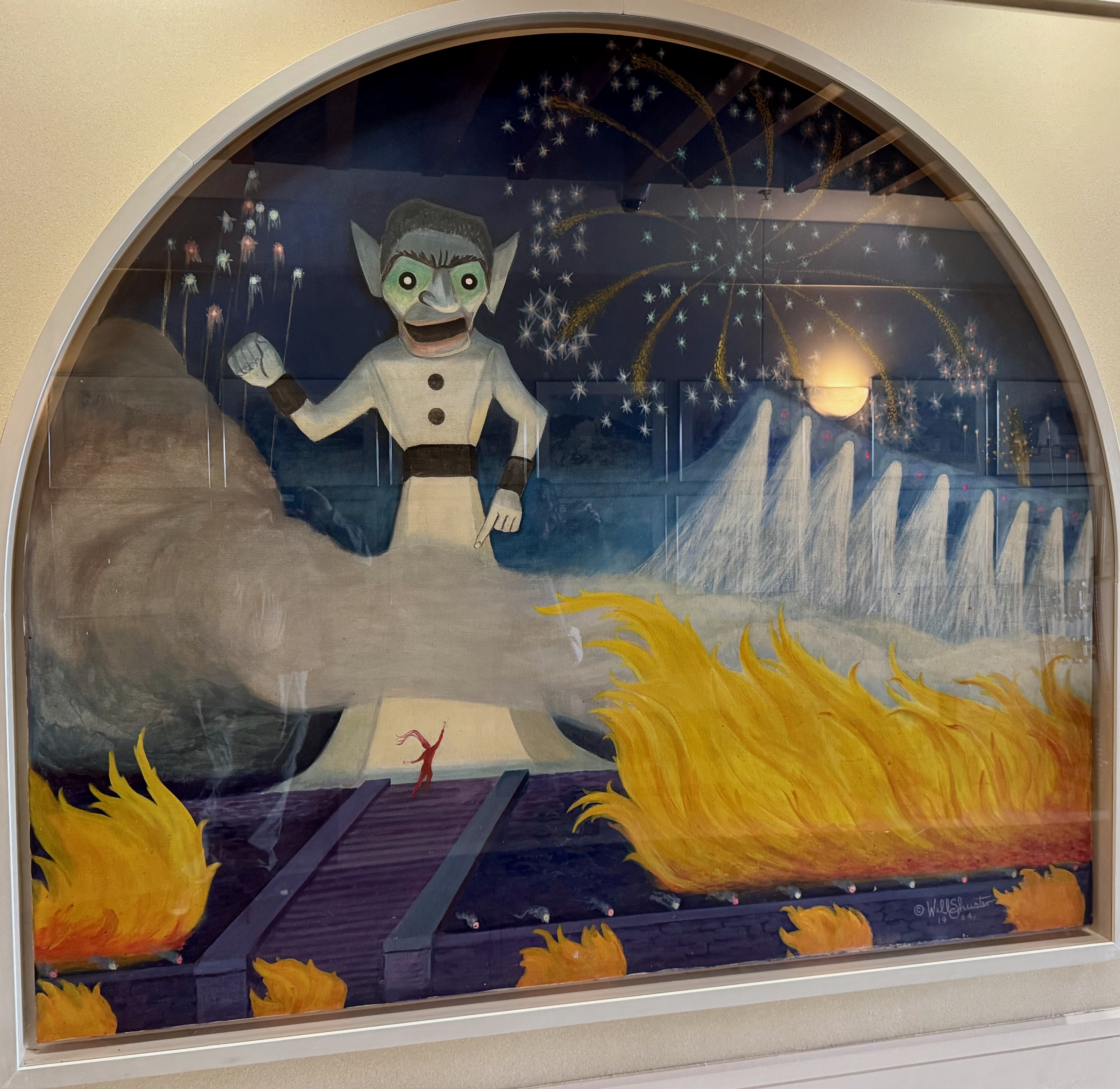
Will Shuster, a lively member of the Santa Fe art colony and the famous artists’ group “Los Cinco Pintores,” came to Santa Fe from Philadelphia in 1920 to recuperate from injuries he received after being gassed in World War I. He remained in Santa Fe after his recovery and was loved by all who knew him. In 1926, Shuster, along with other members of the artist colony, felt that the annual Santa Fe Fiesta had become dull and commercialized and decided to liven it up. “Somebody had been down to Mexico,” Shuster recalled, “and had seen a parade where they carried a figure of Judas and beat it with colored whips and later burned it.” Shuster created the effigy, named “Zozobra” (old man gloom) by E. Dana Johnson, Shuster’s friend and editor of the Santa Fe New Mexican.
Every year, Zozobra’s anguished moans and groans loudly proclaim the death of gloom, doom and despair and the beginning of fiesta! Through the years, Will Shuster has come to represent the early Santa Fe art colony itself, just as Zozobra has come to symbolize the Santa Fe Fiesta.
I bet hotel rooms are expensive Labor Day weekend.
The next morning: cold rain in a campground in Bandelier National Monument, above Frijoles Canyon, where the Ancestral Pueblo people carved cave dwellings out of volcanic tuff beginning about 1100. (The eruption of what we call the Valles Caldera, 1.1 million years ago, was 600 times greater than that of Mount St. Helens in 1980.) They grew corn, beans and squash, ate native plants, hunted deer, rabbit and squirrel, and herded turkeys (herded turkeys?). The tribe abandoned the territory about 1550, moving into areas along the Rio Grande, perhaps because they had worn out the land.
Woodrow Wilson created the monument in 1916, honoring ethnologist Adolph Bandelier, who had studied the sites and cultures of the region in the 1880s. The CCC built out the park in 1934—the road into the canyon and the buildings, originally tourist lodges and now Park Service facilities. The Frijoles Canyon is stunning in spring, when green shoots contrast with muted rock hues. The cave dwellings are accessible from ladders.
About a thousand feet above the Bandelier canyon on the Pajarito Plateau sits Los Alamos National Laboratory, home of the Manhattan Project. J. Robert Oppenheimer requisitioned Bandelier’s tourist lodges for housing. I spent parts of two days going through the historic (and unclassified) Los Alamos campus, including the building where Oppenheimer gave that speech after Japan surrendered and Christopher Nolan staged the event for Cillian Murphy’s character. The house where Robert and Kitty lived is a hundred feet from a pueblo ruin. The campus is one-third of Manhattan Project National Historical Park (created by Congress in 2014), where the bombs were designed and assembled. (The rest of the park is at Oak Ridge, Tennessee, where uranium was enriched, and Hanford, Washington, where plutonium was processed.) The Park Service’s visitor center was closed because of Trump’s hiring freeze, but a locally operated visitor center and a bookstore/museum are steps away.
Down the street is the Bradbury Science Museum, which traces the history of the bomb. On display is a copy of the letter Einstein wrote to Roosevelt in 1939, a month before Hitler invaded Poland, advising him that the Nazis were probably at work on a bomb. Other exhibits explain some of the unclassified projects of the 17,000 employees at the lab, like researching U-238, which powers our deep-space probes. Driving through the Los Alamos campus, I thought about what makes the United States an empire: We have drawn from the world the best and brightest minds to solve complex technological problems, granting us a staggering standard of living. And how the Trump administration is defunding research, restricting immigration, siphoning taxpayer money for corporate rent-seekers. . . .
Later in the afternoon, I stopped at the two-lane bridge over the Rio Grande Gorge, opened in 1965. It is 600 feet above the river snaking through the canyon it formed millions of years ago. From the rest stop (as close as one can get because of obstacles erected to prevent suicide off the bridge), I pulled out my phone and watched the Artemis blast off from Cape Canaveral.
I am in awe of our ingenuity—to commit genocide and travel to the moon.
Driving up Colorado’s San Luis Valley toward the headwaters of the Rio Grande, I saw several highway signs relating the history of its settlement. Before Mexico won its independence in 1821, the Spanish overlords awarded vast land grants to aristocrats and communal grants to lower classes, as buffers from Indigenous tribes. After 1821 Mexico awarded land grants to encourage settlement and buffers from the encroaching United States. In 1806 Jefferson had sent Lieutenant Zebulon Pike—he who failed in his attempt to climb the Peak—to the southwestern Louisiana Purchase. When his soldiers entered the San Luis Valley, the Spanish captured and marched them to Santa Fe for questioning. Pike’s report stirred American interest in what became the Republic of Texas 30 years later.
After the Mexican American War, Anglos began moving into the valley. A sign off the Los Caminos Antiguos Scenic Highway between Fort Garland and Alamosa tells what happened next:
Ready or not, with the Treaty of Guadalupe Hidalgo in 1848, Hispano settlers (pobladores) of the San Luis Valley became Americans overnight. The pobladores of the large land grants were legally granted citizenship of the United States and their property rights were to be recognized. Most of the pobladores did not speak English or have an understanding of the United States government or culture. They were unaware that their land was being bought and sold with the stroke of a pen as far away as New York and Holland. When pioneering Americans from the east came to the San Luis Valley to claim their land, they arrived to find thriving Hispano communities. The pobladores, unable to prove that they owned their land, were treated as squatters, ejected, and forced to buy their land back. The valley became the focus of hundred-thousand-acre land disputes. By the early 1900s, millions of acres of former land-grant territories in the San Luis Valley had changed hands.
Out of the San Luis Valley arise the dunes of Great Sand Dunes National Park. It’s only 700 feet to the top of the highest mounds, but their base is 8200 feet above sea level. This was the hardest climb for me since Machu Pichu Mountain (from 9000 to 11,000 feet). It isn’t just the thin air, it’s that on slopes that are at the angle of repose, it’s a step forward and a slide backward. And when I stopped to rest (frequently), my calves were still firing, holding me upright in the tumbling sand. My friend Chris, who told me to come here, did not inform me that about the 30-mile-an-hour winds or the temperature this time of year. It was 27 degrees at dawn in the campground.
The sand was once under a lake covering the valley between the west-side San Juan and east-side Sangre de Cristo mountains. The dunes, 400,000 years old, remain where they are because creeks off the Sangre de Cristo wrap around them. Prevailing winds, about 40 miles an hour this day, push the sand toward the range, and the creeks wash the sand back downhill.
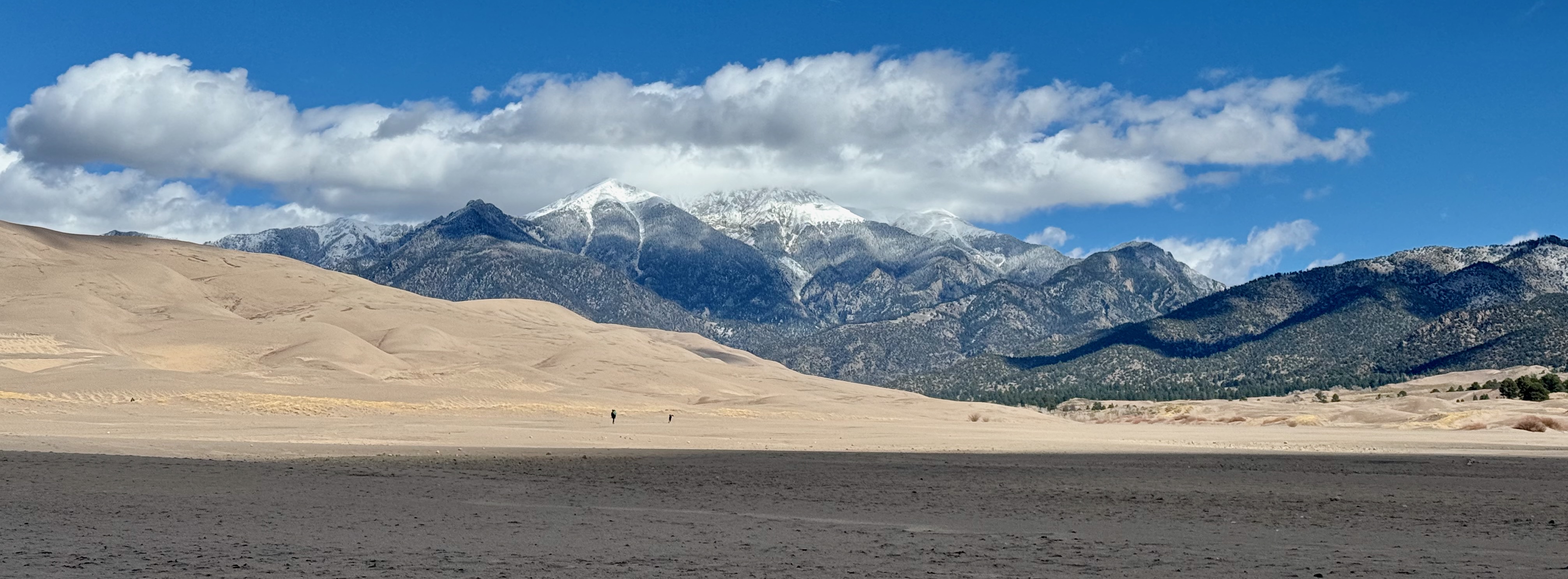
In the 1920s industrialists sought to mine for gold in and make cement out of the dunes. In stepped the local Ladies’ P.E.O. (Philanthropic Education Organization), which in less than two years won the backing of the Colorado legislature and then Herbert Hoover to protect them. Congress converted the monument to park status in 2000, with conditions including acquiring additional land and creating a wildlife refuge. The Bush administration met them in 2004.
The next day I drove over the snow-bound San Juans into the Colorado Plateau, which USGS defines as 130,000 square miles (360 miles square) with distinct fault lines. A rougher but easier concept is that it’s the drainage of the Colorado River and its tributaries across the Four Corners, an uplift of about two kilometers and dating to the early Cenozoic Era—the last 66 million years since the extinction of the dinosaurs. The plateau is not the entire Colorado Basin; the Green, for example, cuts through the Unitas as it flows into the basin.
I stopped for lunch and a stroll in Durango, where downtown features old architecture, new restaurants (including an L.A. chef who opened a Himalayan outpost), used bookstores (always my favorite), and the museum of the Durango & Silverton Narrow Guage Railroad, which carries tourists between the two cities, about 50 miles apart. The (free) museum is charming: a huge model railroad, steam engines to climb on, and a variety of trains, planes and automobiles.
Just west, I stayed the night with my D.C. biking buddy from a previous life, Jeff, and wife Jenn, in the community of Mancos. It might rise to the level of village—there are art galleries, a few restaurants, a cidery. Jeff and Jenn live on a dirt road three miles from the center crossroad, in the valley of the San Juan River, in sight of the Mesa Verde National Park plateau. “Where the West still lives,” it says on some license plates; with pride others characterize it as “steers and queers” for the mix of ranchers and artists who come together as true neighbors.
The next morning, after breakfast at Moondog Cafe, Jeff and Jenn took me on a day-long tour of Mesa Verde and its stunning cliff dwellings. We hiked through a canyon for a couple hours and examined the variety of abodes. The cliff dwellings from the 12th and 13th centuries are iconic, but on the mesa are pithouses dating to the 6th century. As indigenous people settled, their stonework and basket-weaving evolved in distinct stages, I guess until they were done evolving baskets and turned to building ever more elaborate apartment buildings. Cliff Palace was the final result. And then it and the rest of these cities were abandoned in 1285, as were settlements throughout the region.
Mesa Verde is the most famous of these settlements. Also the first national park (1906) protecting an archeological district, as opposed to a wonder like Yellowstone or Yosemite. Except for its striking size, it’s not a type of village unique to the Four Corners. The region emptied out of people all at once, apparently from drought and its consequences—hunger and warfare. Like those from Bandelier and elsewhere, survivors settled southeast in the Rio Grande Valley.
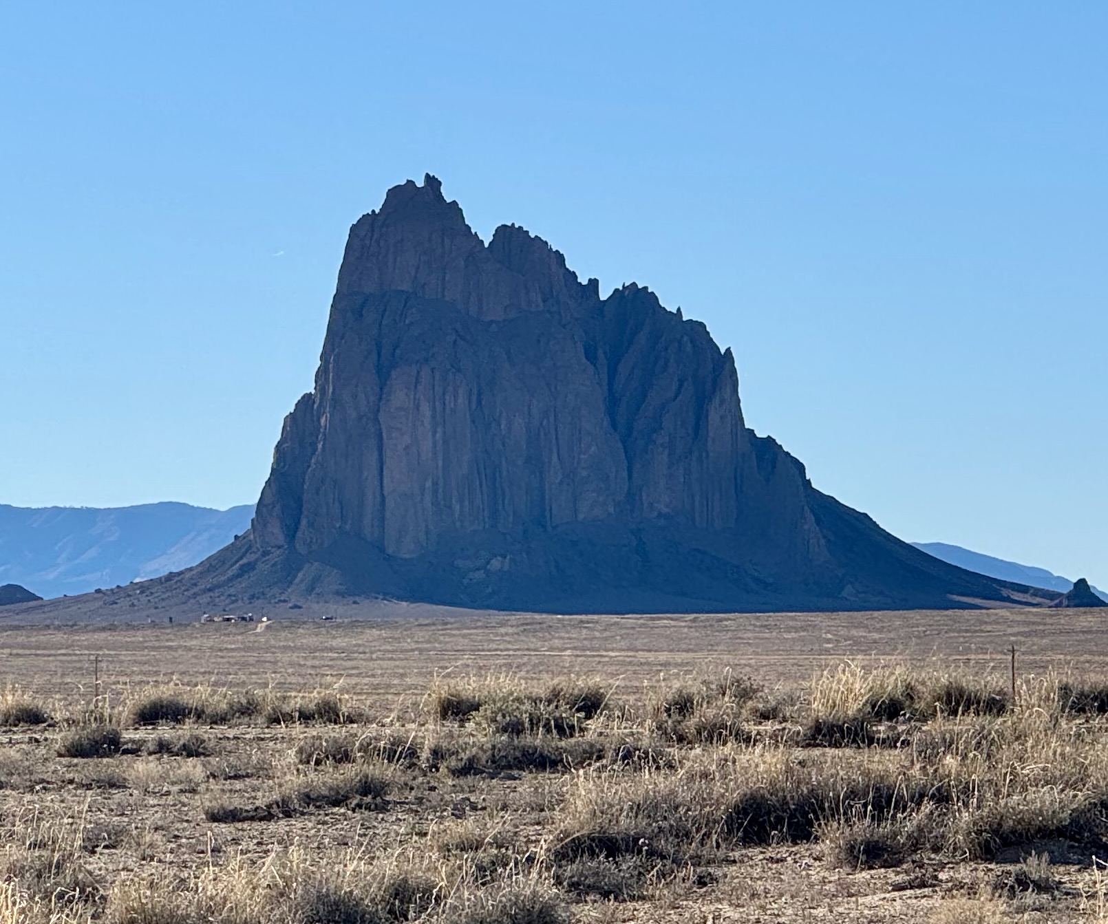
In the late afternoon, I sped southwest toward my favorite haunted mountain, Shiprock, on the east side of the vast Navajo Reservation. Haunted because of an experience in 1989 of this dragon’s-tail-shaped formation, the neck of an eroded volcano.
On a tour of the Four Corners that Thanksgiving, my (ex-) wife and I approached Shiprock from Chaco Canyon, the ceremonial capital of these ancient peoples. In a rental sedan, I drove onto grooved paths approaching the peak, but as the ruts grew deeper, Heather intuited a fearful vibe about the place, and I felt like we were invading alien territory. Shiprock resembles Mount Doom. I reversed course onto US-491 and then drove west on the empty Highway 13. Over the Arizona line, the pavement turned to dirt as we climbed 2,000 feet over Buffalo Pass. No other cars on the road this late Sunday morning. On the descent, a rock shattered the unprotected oil pan of our under-engineered Ford. Uh oh. I turned off the engine—and rolled seven miles downhill into a gas station in the hamlet of Lukachukai. Which appeared to consist of three houses and the closed gas station. (Heather exclaimed: That’s it! That was the bad vibe!) I knocked on the closest door, and a young man answered, the only one in the house who spoke English. He was about to drive Grandma to the health clinic in Chinle, where we had reservations at the Thunderbird Lodge, within Canyon de Chelly National Monument. He dropped us at the lodge. Overnight, the rental company sent two cars from Colorado Springs; our replacement Ford Taurus arrived before check-out time, and we continued our journey with a story about a bump in the road.
On this evening in 2026, I pulled off the highway to gaze at that striking formation, the bright sun sinking behind dragon’s tail that trails away from the peak. Across the Arizona border, the dirt road over Buffalo Pass was paved, though not lately. It’s full of potholes and gaps from erosion on the Lukachukai Range. I did not notice the gas station as I whizzed by on my way to Thunderbird Lodge.
Canyon de Chelly looks about the same as it did four decades ago. The Thunderbird cafeteria was built as a trading post in 1902. Over three decades the post morphed into a tourist hotel, rows of simple rooms constructed of stone. For dinner I ordered beans and fry bread, and in the morning joined two couples for a day-long tour of the sandstone canyon narrated by Tyriol, a Navajo man who’s given tours daily since before I was last here in 1989.
The canyon has a history like Mesa Verde’s—peoples who lived here for thousands of years until the drought of the late 13th century. But unlike Mesa Verde, Canyon de Chelly National Monument is within and owned by the Navajo Nation; the Park Service’s role is primarily to protect the ruins within the canyon. Also unlike nearly all national monuments, Congress passed a bill authorizing its creation, in 1931 after a decade of consultation with the Navajo.
For several years the Park Service and the tribe have co-managed it. Tyriol is unimpressed with the tribe’s stewardship. It collects a $75 fee for each guided tour (only Navajo may enter the canyon freely); he doesn’t see the revenue being plowed back into maintenance of roads or anything else. I signed a form on behalf of our fivesome agreeing to the rules, including no photos of Diné without permission. I didn’t even ask.
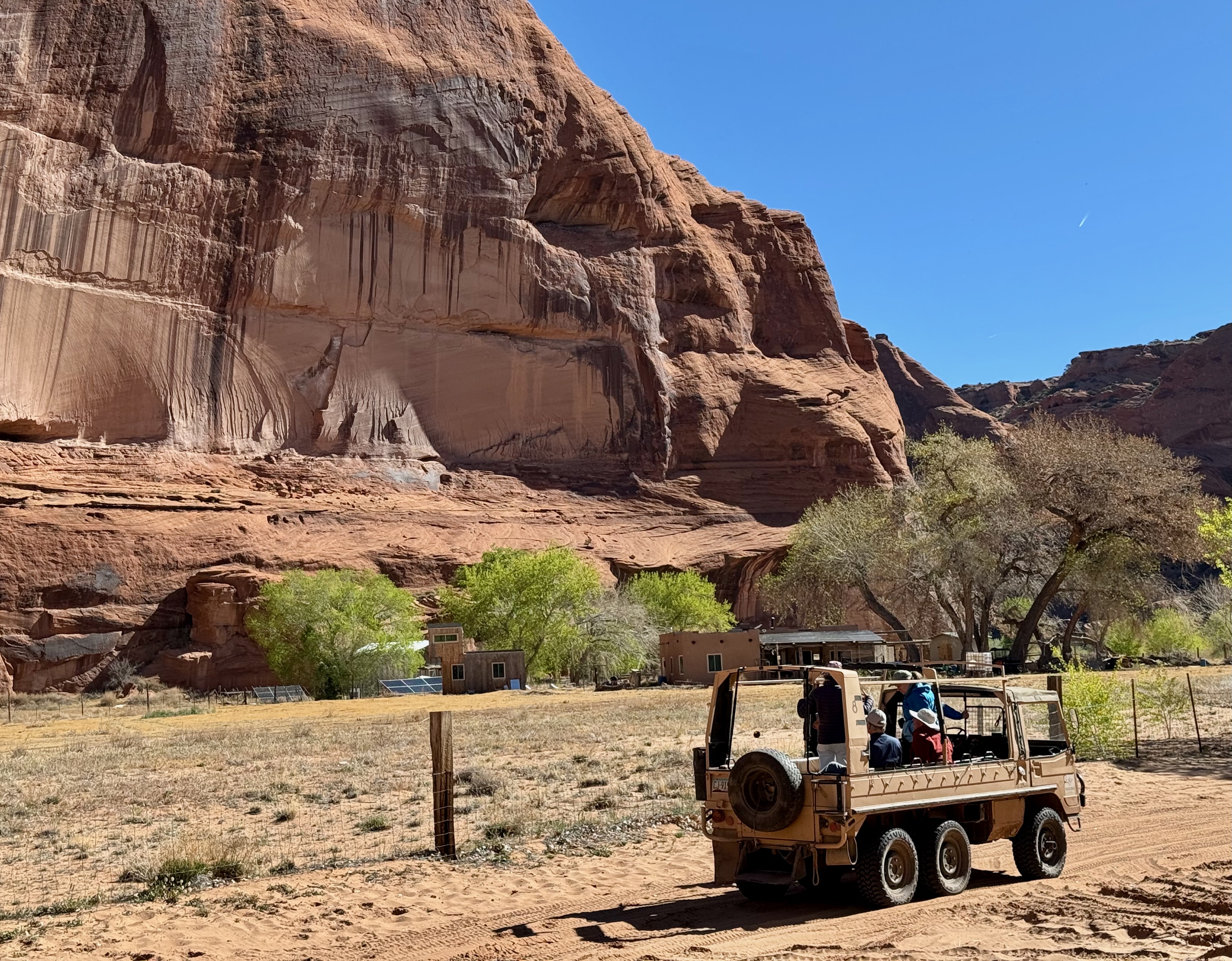
Tyriol drove a six-wheeled, four-stick-transmission flatbed truck, stopping to narrate cliff dwellings, pictographs and petroglyphs. At the far end, three hours later, we gazed at Massacre Cave, in a thousand-foot wall, where in 1805 the Spanish, attempting to quash conflicts over their push into Diné lands, killed more than 115 elderly men, women and children while the hunters were away.
For me the most meaningful landmark in the canyon is Fortress Rock. In 1863 Colonel Kit Carson was ordered to remove the Navajo to a reservation near Santa Fe. His command laid siege to the rock, where 300 people had climbed a cliff 700 feet above the canyon floor attempting to escape the army’s notice. Carson starved them out and marched 10,000 natives 400 miles to “Bosque Redondo,” an internment camp, where Brigadier General James Carleton insisted he could convert the Indians to American-style farmers. The water was alkaline, the crops failed, and more than 3,500 people died of disease. In 1868 the enterprise was abandoned and the tribes were allowed by treaty to return to their homes, including in Canyon de Chelly. About 40 families live there.
At an oasis in the canyon, a grandfather pitched the pottery and jewelry his family makes and sells on the spot. He explained that he learned by watching, as do his grandchildren. Each potter brings personal style to the wood-fired pots that are painted with such precision I can’t believe they weren’t done on a machine. On our return late in the afternoon, the man’s grandson peppered me with questions about the NBA. Tyriol noted that every home in the canyon has a hoop. (“Basketball or Nothing,” a 2019 docudrama about Chinle’s high school basketball team, has run on Netflix.)
Canyon de Chelly, Bandelier, Pecos, Mesa Verde: These sites are of a piece. Their people have lived here since “time immemorial.” Their architecture, artifacts and culture bear similarities. Our dominant White ethos would do well to emulate their connection to the environment. Instead, the Trump administration gave the public one week to comment on its plan to remove the 10-mile buffer around Chaco so that it can lease the land for oil-and-gas drilling. On the other hand, the Navajo Nation sued the Biden administration over the buffer, contending the limit on oil-and-gas drilling imposed economic hardship on tribal members. That suit was settled as the BLM announced the proposed elimination of the buffer. I expect other parties, including the National Trust for Historic Preservation, will litigate.
BLM administers one-tenth of the surface of the country and one-third of subsurface mineral land. In May the Senate confirmed former New Mexico congressman Stevan Pearce, an advocate of selling public lands, as its director on a party-line vote of 46-43. (The Senate has so tired of its advice-and-consent obligation that the motion included confirmations of 49 nominees.) More than 80 conservation and public land access groups opposed his nomination in a letter to the Senate Energy Committee; supporters included oil and gas lobbyists and grazing interests. The committee didn’t bother to file a report on its hearings or deliberation.
As Shanley Hurt wrote in the Substack Geddrey: “Public lands aren’t just scenery. They are habitat, carbon storage, clean water, Indigenous history, recreation, refuge, and the last quiet places many Americans will ever know. They are where pronghorn move across old migration routes, where old forests hold water in their roots, where families camp under stars they cannot see from the city, where children learn that the world is larger than commerce. When these lands are leased, drilled, mined, fragmented, and reduced to what can be extracted from them, something is taken that cannot simply be bought back later.”
As migration was as normal for the Ancestral Pueblo as it is for us, I consider: Who really owns this land? Archeologists propose that diminished resources drove them away. So what of us, building metropolises in the deserts of Las Vegas, Phoenix, Tucson?
From Chinle I drove south to Ganado, site of the Park Service’s Hubbell Trading Post. When the Navajo were freed to return to their lands, Ganado Mucho, a tribal leader and one of the signatories to the 1868 treaty that freed the Diné, became a negotiator between the government and the Indians. He invited his colleague, John Lorenzo Hubbell, to establish a trading post at Pueblo Colorado on the reservation.
Born in New Mexico Territory in 1853, Hubbell was the son of a trader and rancher from Connecticut and the daughter of a prominent Mexican family. The son grew up in the family business; was fluent in Spanish, Navajo and English; and became a translator at Fort Defiance, the U.S. government’s headquarters on the reservation. He had a trading post there and opened a second at Mucho’s suggestion. The business thrived, as did Hubbell’s reputation. (He had another post at Chinle, on the Atchison Topeka & Sant Fe line.) Hubbell later served the first term of the Arizona State Senate.
Authorized by Congress in 1965, the Park Service acquired the post from Hubbell’s descendants. It maintains Hubbell’s original home and operates a small museum and rug store. The museum’s narrative is hagiographic of Hubbell and his legacy. But one paragraph in its narrative struck me:
“By the 1880s, Navajo sheep herds were again thriving and were a valuable resource. When wool was in good supply, Navajos could weave blankets and rugs to trade for substantial store credit.”
I remarked on this passage to Ranger Burbank, a late-middle-aged Navajo who greets visitors and engages in the history of the place that is his life. Sounds like a company store, I said: Hubbell sets the price and controls the exchange. Thus we fell into conversation. “Have you read Howard Zinn?” We talked about slavery, conquest, Manifest Destiny and Theodore Roosevelt and exchanged book recommendations.
I spent a couple hours researching Hubbell, finding a rabbit hole of narrative. On her website appropriately named “Legends of America,” Kathy Alexander quotes Hubbell:
“I know a lot of people have the idea that an Indian trader is a first-class scoundrel—a man who attains financial prosperity by fleecing the Indians. There may have been some that have, but they didn’t last long. I’ve been an Indian Trader for fifty years, but I’ve dealt honestly with them. I’ve never taken a dollar from an Indian without giving the Indian value received, and I’ve often given the Indians what should have been my own legitimate margin of business profit just to help them when they need it.”
Once upon a time—about 220 million years ago—Arizona was about where Costa Rica is now, at 10 degrees north of the equator, part of the supercontinent Pangea. Dinosaurs roamed a tropical rainforest, bound by mountains on the east and south, the ocean on the west. Rivers of volcanic ash buried organic material, preventing oxygen from breaking down dead flora and fauna. By 70 million years ago, Pangea had broken up, taking North America—north. The flood plain lifted like a spatula under a pancake, creating the Colorado Plateau. Over millions of years, silica replaced carbon in the buried organics, the climate dried, and erosion from wind and water exposed the fossils—and voila! Arizona’s Petrified Forest National Park. A nanosecond ago, in 1906, Roosevelt proclaimed it a national monument. As more fossil beds were discovered, presidents expanded protections until Congress created the park in 1962. Its boundaries were last expanded in 2004.
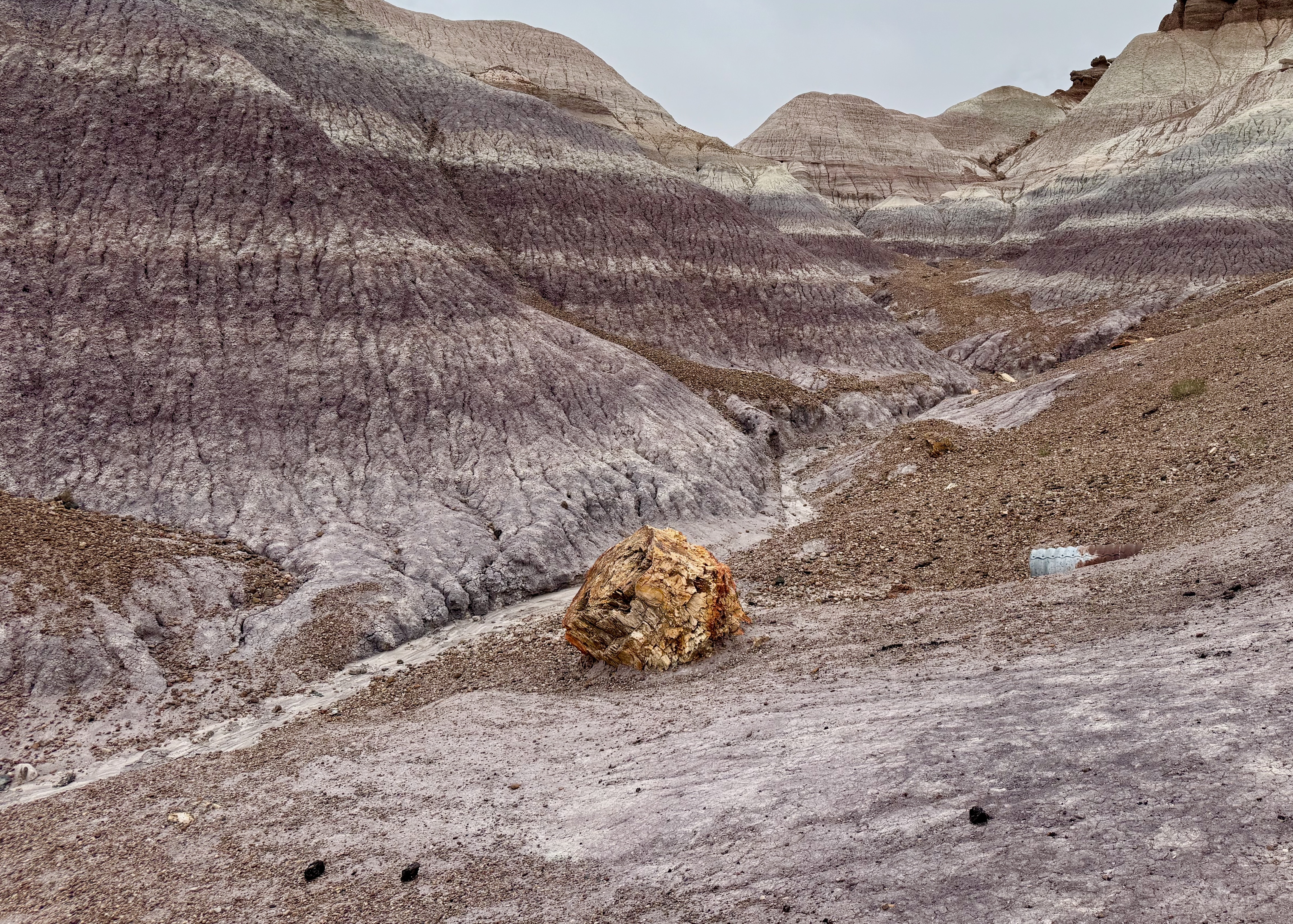
The 27-mile road through the park reveals wonders. In the north the Painted Desert is a canvas of eroded ocre badlands. South of I-40 the Chinle Formation’s layers of gray, purple, beige and red reflect the clay’s predominant mineral—iron, carbon, manganese. Walking through the bentonite clay hills is a trip through a miniature canyon, the water and wind wearing in the same patterns of a mountain, only smaller.
In the far south is the petrified forest: huge logs, some 30 inches in diameter, broken into segments as if by the cut of a saw. The breaks resulted from the erosion of the encasing clay, so that the weight of a log—200 pounds per cubic foot—snapped under the force of gravity. The forest is a fraction of what was before Americans began carting off souvenirs in the 1850s. (As a person captivated by colorful stones, I felt tempted.) That theft, among the other depredations of ancient sites, spurred John F. Lacey to act. Without him, we might not have any “national monuments.”
Lacey was born in 1841 in Virginia, moved to Iowa at 14, served throughout the Civil War, then became a lawyer representing the Rock Island Railroad. From that perch he developed an expertise in interstate law and traveled the West. He was first elected to the House in 1888, lost the seat two years later, regained it in 1892, and chaired the Public Lands Committee from 1895 until 1907.
Among the laws Lacey drafted/sponsored/legislated:
- The Forest Reserve Act of 1891, under which Grover Cleveland and his successors designated what became national forests;
- The Yellowstone Park Protection Act of 1894, which made it a crime to poach or harvest anything in the park, protections that until then existed only paper;
- The Lacey Act of 1900, which prohibited interstate trade in wildlife, fish and plants taken in violation of state laws, and barred the introduction or import of injurious species.
- Roosevelt’s big stick, the Antiquities Act, by which Congress granted the president authority to create on federal land “national monuments” of “historic landmarks, historic and prehistoric structures, and other objects of historic or scientific interest,” provided that the parcels were “confined to the smallest area compatible with the proper care and management of the objects to be protected.”
Lacey’s reelection loss in 1906 was one of 28 for Republicans, after five years of Roosevelt’s presidency. He joined the Agriculture Department, where he successfully pushed a bill protecting migratory birds. The Lacey Act of 1900, amended most recently in 2008, is the primary law behind the Interior Department’s obligation to protect wildlife and wildlife refuges.
Driving west toward Flagstaff, I was approaching the ultimate of the trip. But before I arrived at the Grand Canyon, three national monuments were lined up along the way, south to north.
Walnut Canyon, created by Woodrow Wilson in 1915, and Wupatki, declared by Calvin Coolidge in 1924, preserve Ancient Pueblo dwellings. A visitor could crawl into some of Walnut Canyon’s dwellings from a mile-long Park Service loop trail—don’t. You are allowed to walk through Wupatki’s extant pueblos.
In between the two sets of ruins lie the lava field of Sunset Crater, which erupted in 1065. Sunset is a black cone above fields of jagged boulders and cinders. Named by John Wesley Powell for its colorful minerals, Sunset Crater had the most recent eruption among 600 volcanos around the San Francisco Peaks looming over Flagstaff. Herbert Hoover gave it monument status in 1930 in response to a Hollywood producer’s notion to apply dynamite to it as the climax to a silent-movie adaptation of a Zane Grey western, Avalanche. The founding director of the Museum of Northern Arizona, Harold Colton, organized opposition and petitioned for protection. (The moviemakers blew up a different slope.)
Nomadic peoples occupied the area for at least 13,000 years. Archeologists labeled this prehistoric culture Sinagua, from the Spanish name for the region, Sierra de Sin Agua, or “mountains without water.” As at Mesa Verde, the people began moving off the mesa and into the Walnut Canyon around 1100. A Park Service narrative notes, “They left no written history when they departed the Flagstaff region sometime before 1250. In the 1880s pothunters removed many Sinagua possessions, dynamiting some of the cliff-dwelling walls to allow in more light for their search.”
Construction of the multilevel Wupatki pueblo began after Sunset Crater had cooled, around 1100; its inhabitants abandoned it in the middle of the 13th century. Probably because there’s no water. Its pueblo ruins are stark against the desert, but the national monument, now nearly 56 square miles, consists of hundreds of sites where artifacts have been found. For the 13 tribes who claim Wupatki, the area is not a ruin. On a page of the National Trust for Historic Preservation, Cecilia Shields, an interpreter for the monuments, explains its significance. “For many groups there was no written language, so history was preserved orally. These oral histories are so important that they’ve become song, they’ve become prayer, they’ve become ceremony. It’s a way of preserving the culture.”
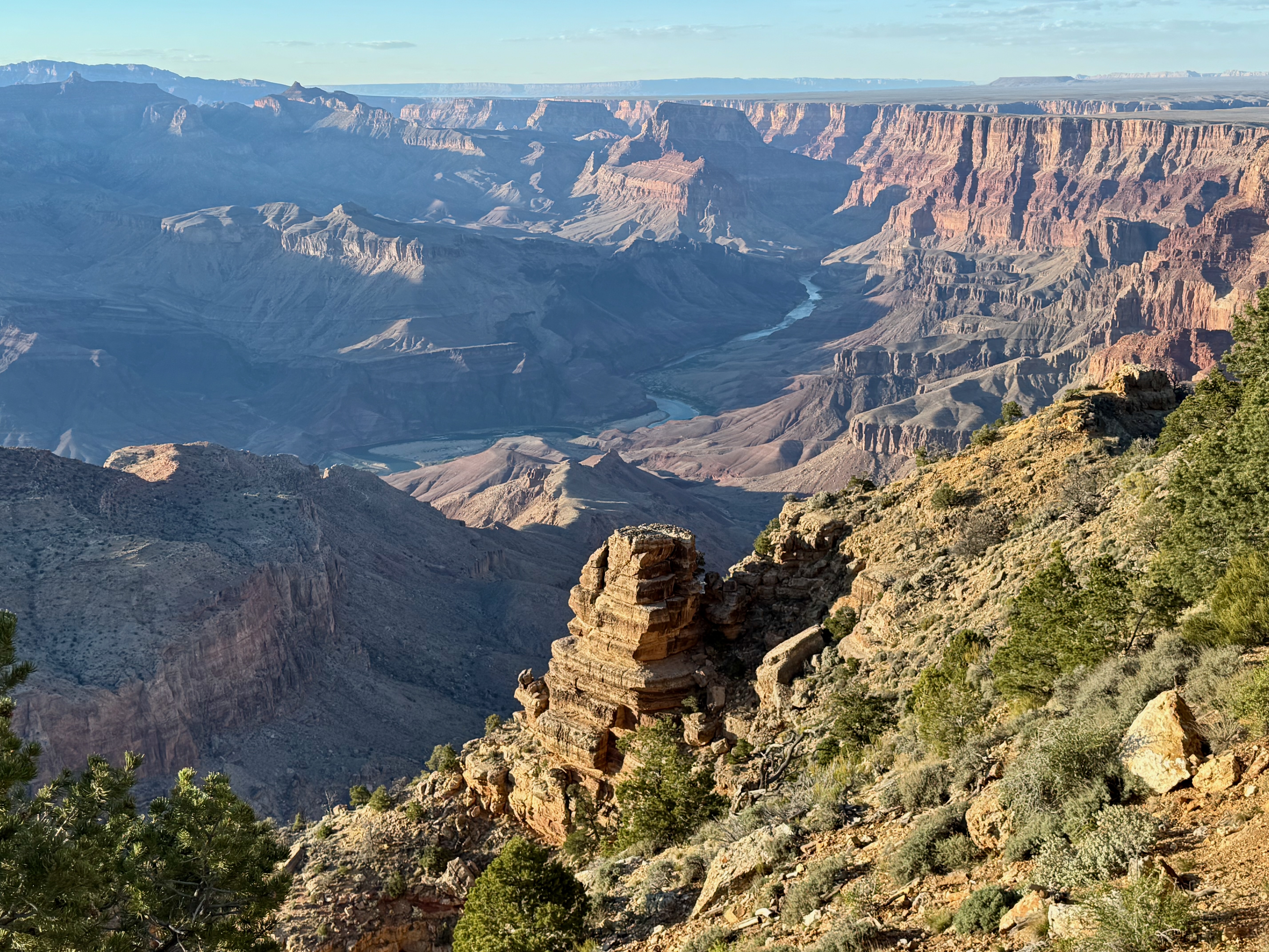
Grand Canyon was the aim of the trip. When I finally arrived, I was reading Kevin Fedarko’s A Walk in the Park, an account of his barely credible, 750-mile hike across the trail-less bottom of the canyon. A handful of others have made the trek without a break; Fedarko and his friend, National Geographic photographer Pete McBride, both experienced adventurers but undisciplined and unprepared for the rigor of the excursion, had help from a community of canyon veterans in Flagstaff. I intended nothing of the sort. But every time I come here, I have an unexpected experience. This one was informed by the preceding days in pueblos and cliff dwellings.
Like everywhere else on the continent, people lived here before Euro-Americans arrived. After John Wesley Powell reported on his second voyage down the Colorado in 1871-72, miners began expelling the tribes. (A former uranium mine on the South Rim is a Superfund site.) When Congress created the park, the nascent Park Service, established in 1916, used its power to control access and remove natives.
So when I step off the South Rim at Bright Angel, I’m not taking a hike into an uninhabited wilderness. Eleven federally recognized tribes have ancestors who lived and died here: Havasupai, Hualapai, Hopi, Zuni, Navajo, Yavapai-Apache and five Southern Paiute groups. The Havasupai roamed the Colorado Plateau until 1882, when the U.S. confined them to a 518-acre reservation, and in 1928 the Park Service removed them from the oasis halfway down the Bright Angel. The Hopi farmed here. The confluence of the Little Colorado and the Colorado, just east of the park boundary, is sacred to the Navajo. Glen Canyon Dam was built on traditional Southern Paiute lands. As Fedarko writes, once you understand this history, you will never see the canyon the same way.
And what you see is incredible. I try to wrap my head around 1.8 billion years, starting with the volcanic Vishnu formation, 2000 feet above sea level, where the Colorado flows. Above that, 1.2 billion years is missing, having blown away in the unimaginable past. The top layer of rock is 270 million years old—the history above that also blew away. Still, there’s 5,000 vertical feet of accumulated sediment from the South Rim to the river in 40 distinct layers. They grow more distinct every time I descend.
I was fortunate to pick a mild day with afternoon haze for my eight-hour, 13-mile walk past Havasupai Gardens, where the creek falls west over a cliff and the Bright Angel Trail drops to the east into a series of switchbacks known as Devil’s Corkscrew, still 1300 feet above the river. From experience, I thought it prudent to turn around.
My routes into this place are tiny squiggles. I will never know more than a minuscule fraction of it. I’ve read a little. A bit of the Canyon became a forest preserve in 1893 and a national monument in 1908. Congress created the park in 1919 and doubled its area in 1975. In 2023 Joe Biden declared a national monument of three parcels covering 918,000 acres adjacent to the park: the Baaj Nwaavjo I’tah Kukveni-Ancestral Footprints of the Grand Canyon. “The monument protects thousands of cultural and sacred sites that are precious to Tribal Nations in the Southwest,” the BLM said. Which I read as a modest effort to make amends to the Indians for overrunning their continent.
Some words on the canyon’s political development, because it applies generally to the protection of public land. The context has always been public enjoyment versus private profit, and it remains today. As noted, in many cases locals led efforts to protect nature. In others they demanded the right to extract and exploit—and get rich. For decades Grand Canyon fit the latter.
Roosevelt’s national monument proclamation was controversial in its size: 1,280 square miles. Perhaps a lot bigger than Congress had intended when it passed the Antiquities Act. On the other hand, the president’s actions reflected his impatience with a dawdling Congress. (Douglas Brinkley, who titled his biography Wilderness Warrior, exhaustively recounts Roosevelt’s preservation of flora and fauna.)
Now enters Ralph Henry Cameron, a prospector and businessman who had gone west in search of riches. (My primary source is Douglas Strong, who wrote two articles published in Arizona and the West.) Between 1891 and 1927, Cameron manipulated his public offices—county sheriff, county supervisor, congressional delegate and U.S. senator—to advance his ventures in mining and tourism.
Cameron moved to Arizona to pursue copper, and after some success below what became the first tourist site on the South rim at Grand View, he left mining behind. He and his partners filed mining claims along the ancient Bright Angel trail to Havasupai Gardens, not to mine but to control the trail and access to the canyon—an abuse of the 1872 Mining Law. He competed with the Atcheson Topeka & Santa Fe for tourists; their fierce battle led the railroad to rebuild the end of its 64-mile spur from Williams away from Cameron’s hotel atop Bright Angel and to establish a second destination at Hermit’s Rest and improve a trail there to a luxurious campsite in the canyon. Tourists today can take a shuttle bus (or bike or walk) seven miles along the South Rim to the original building at Hermit’s Rest. El Tovar, the ritziest hotel on the South Rim, was built by the railroad.
Cameron’s fight with the government, which in 1909 denied his mining claims, culminated at the Supreme Court in 1920. In Cameron v. United States, the court rejected his mining claims as invalid and affirmed the president’s authority to control public lands under the Antiquities Act. Months after his defeat in court, Cameron was elected to the Senate, where he tried to fire Steven Mather (first director of NPS, namesake of the South Rim’s Mather Point and many other landmarks), delayed park appropriations, and appointed friends and relatives to local offices to further his interests.
What piqued my curiosity was a NPS plaque above the Bright Angel explaining that Cameron, and subsequently Coconino County, owned the trail and charged a $1 toll to use it until 1926, when the county sold it to the Park Service. Huh? How can another entity own a trail in a national park? The short answer is that an elected official can twist his position, the press and the public until dethroned. Meantime, to allow visitors to access the canyon and the river, the park built a second trail, the South Kaibab, which starts at the rim two miles mile east of Mather Point. In 1926 Cameron was defeated for reelection by Congressman Carl Hayden, a Grand Canyon advocate. Six years later Hayden again defeated Cameron by 2-to-1 and went on to serve until 1969.
After the exhilaration of the Grand Canyon, I felt enervated, not inclined to ambitious hiking or even camping. I spent the night at a Navajo hotel in Cameron (name derivation unclear), on the bank of the Little Colorado at US-89. Back at Hopi House on the South Rim, I’d been infatuated with a 28-by-30-inch Navajo rug of extraordinary color and complexity, called Teec Nos Pos. I’d returned to the shop to study it, mulling its $2700 sticker, and took the name of the weaver (Darlene Littlehen). I settled for a T-shirt. At Cameron, I walked into a room filled with rugs and chatted with a Hopi woman about Navajo patterns and their history. Even at twice the price I didn’t see anything as beautiful as the rug in Hopi House. A wall hanging in the lodge dining room was $79,000. I bought a packet of postcards depicting rugs.
The next day I began several days driving one my favorite routes in America: from Lee’s Ferry on US-89A, hard against the Vermilion Cliffs (proclaimed a national monument by Bill Clinton in 2000), to Kanab; US-89 to Utah-12 and through Red Canyon and the Grand Staircase Escalante National Monument to Boulder; and the Burr Trail to the Waterpocket Fold in Capitol Reef National Park. I’ve camped many nights in this region; to me it’s a grand staircase: the descent of the Colorado from its confluence with the Green at Canyonlands, down through Glen Canyon to Lee’s Ferry, where raft tours launch into the Grand Canyon.
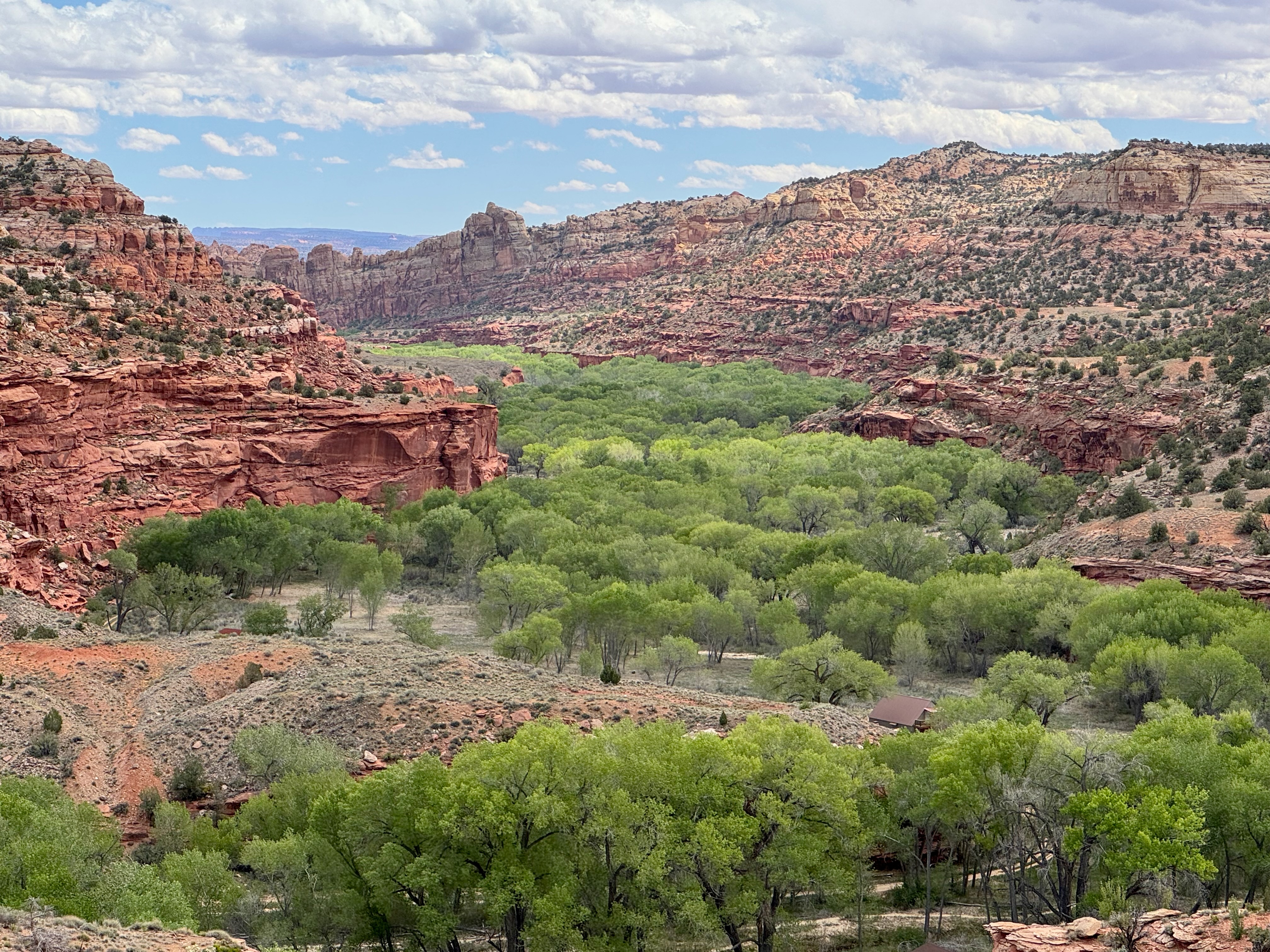
The heart of the Grand Staircase Escalante National Monument is the valley of the Escalante River, named for the Spanish Franciscan who co-led an expedition in 1776 to find a route between Santa Fe and California. On the west side of the valley is Escalante Petrified Forest State Park, a tract much smaller than Arizona’s national park, whose minerals gleam, half-buried, along a couple miles of hiking trails. East of the town of Escalante, on the vertigo-inducing Utah-12 to the river, sits Kiva Coffeehouse, a beautiful spot for a break. At the river, a 70-mile hiking trail runs to the Colorado. On the far side, the highway climbs a grade as steep as 14 percent to a ridge barely wider than the highway. At a pullover, I stop and peer down on Calf Creek to the west and Boulder Creek to the east, both tumbling into the Escalante. The road, completed in 1985 after seven decades of construction, required feats of engineering that my wife will find heart-stopping should I bring her here. This aspect of American ingenuity I attribute to the Mormons.
I cast no aspersions of people of faith, but this sect was nuts. Having been chased away from communities in the East, and then in 1847 proceeding to Salt Lake despite Jim Bridger’s advice, the Mormons exercised their knack for thriving in harsh conditions. In 1879, three years after settling in the relatively pleasant valley around Escalante, about 250 individuals answered the “call” from church leaders to establish an outpost on the San Juan River in southeast Utah Territory.
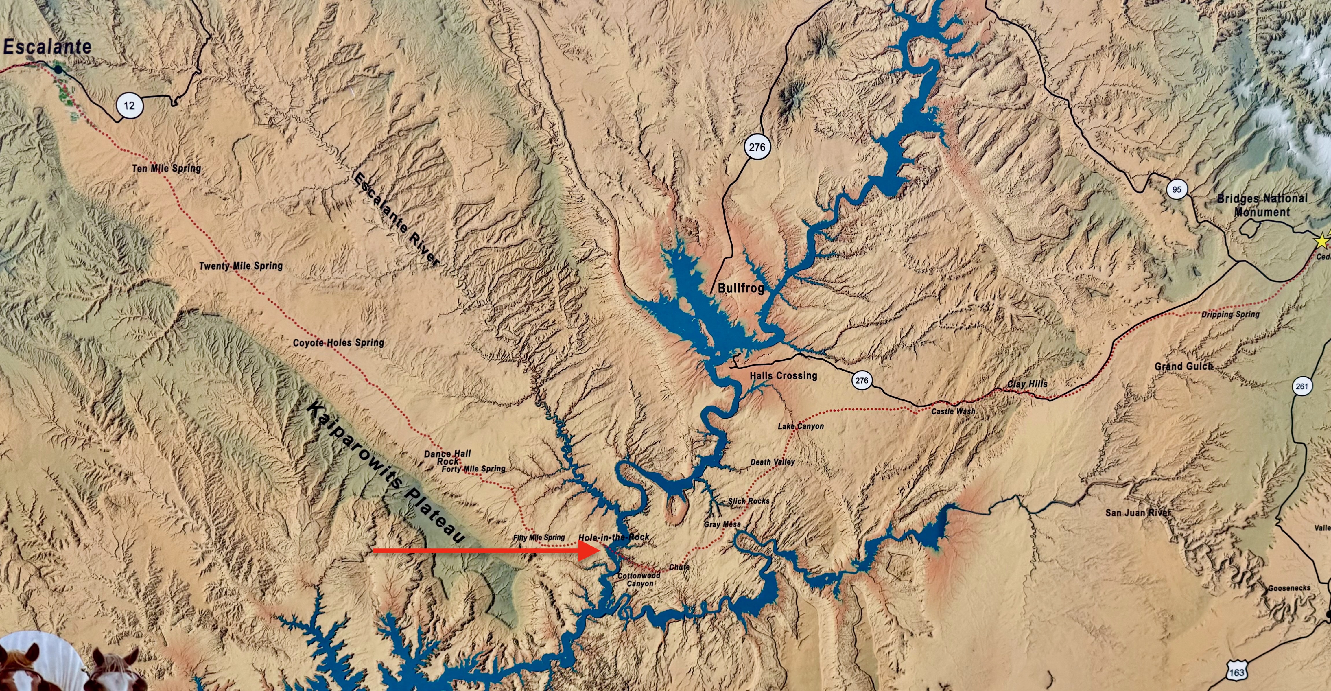
Look at a map to see what a preposterous directive this was. The descent from Escalante included a 1000-foot cliff above the Colorado. The miners among the emigrants were experienced with blasting powder. Over six months, they cut a trail to the river, ever after called Hole-in-the-Rock (now partly submerged by Lake Powell), led 83 horse-drawn wagons and their livestock down the chute, then forded the river and continued blazing their 180-mile path to the new settlement of Bluff. The trail is listed on the National Register of Historic Places.
When I look at brilliant-green farms in the desert, I think of the Mormons. And when I encounter a highway blasted through a cliff, I think of the Mormons.
Twelve miles from the Escalante River is the start of the Burr Trail—asphalt and then dirt—running the town of Boulder to the Waterpocket Fold, the essential attribute of the tube-shaped Capitol Reef National Park. Here’s the NPS description of the last 200 million years around Capitol Reef:
Long after the sedimentary rocks were deposited, the entire region was uplifted thousands of vertical feet, due to large-scale plate tectonic forces. Most of the Colorado Plateau was uplifted relatively evenly, keeping the layers roughly horizontal, creating the “layer cake” appearance common throughout the region (such as at the Grand Canyon). Capitol Reef is a giant exception to this pattern, due to the Waterpocket Fold.
The Waterpocket Fold defines Capitol Reef National Park. A nearly 100-mile-long warp in the Earth’s crust, the Waterpocket Fold is a classic monocline, a ‘step-up’ in the rock layers. It formed between 50 and 70 million years ago when a major mountain building event in western North America, the Laramide Orogeny, reactivated an ancient, buried fault in this region. Movement along the fault caused the west side to shift upwards relative to the east side. The overlying sedimentary layers were draped above the fault and formed a monocline. The rock layers on the west side of the fold have been lifted more than 7,000 feet (2,134 m) higher than the layers on the east.
A walk around the vertical slice of the Waterpocket Fold at the Burr Trail switchbacks—a 600-foot cliff—is disorienting. Studying a photo, I was unsure which was on a horizontal plane, the diagonal cut or the distant prairie. In a region of the bizarre, this is unworldly.
The Waterpocket Fold abuts the Grand Staircase Escalante. Bill Clinton proclaimed the monument in 1996, then Donald Trump shrank it in 2017—raising a fundamental question: Does a president have authority to un-protect a national monument? What’s the point of president preserving an area for future generations if a successor, without Congress or the courts, can erase it?
Many presidents have changed monument boundaries; on rare occasions they have reduced them. No reduction was challenged in court until Trump shrank the Grand Staircase from 1.7 million to 1 million acres and the Bears Ears NM, 100 miles to the east, from 1.35 million to 229,000 acres. The suits, consolidated in federal court in Washington, argued that Congress gave the president authority to create national monuments, not to abolish them, even partly. The court stayed the litigation when Biden reversed Trump in October 2020. Nothing has happened in those cases since.
But two parties—Garfield County and a rancher in adjacent San Juan County—sued in federal court in Utah, arguing that Biden in 2021 had exceeded his authority under the Antiquities Act. The court dismissed the consolidated cases for lack of standing; the 10th Circuit Court in 2023 heard the plaintiff’s appeal. As of this writing, approaching three years later, it hasn’t ruled. If it were to grant the appeal, the case would return to district court for trial on the merits.
In those suits the government (the defendant) argued that whether the particulars of a national monument exceeded the authority granted was a matter for Congress, not the courts. Senator Mike Lee, Republican of Utah and a fierce opponent of federal land, sought to overrule BLM’s management plan for the Grand Staircase, issued in the final days of Biden’s term. In April 2026 he filed a Senate motion that if passed would have voided the plan. Congress did not act on it within the 60 days prescribed under the Congressional Review Act.
Bears Ears, a Barack Obama proclamation (2016), rises from the desert in southeast Utah next to Natural Bridges, another Theodore Roosevelt national monument (1908). When I got the visitor’s center, I asked the volunteer why there was no sign off 95 for Bears Ears, though there were multiple signs for Natural Bridges. Her reply was an unofficial “hush.” The Trump administration has not again shrunk the monument. Interior Secretary Bergum, we may surmise, is busy trying to get drilling going at Chaco Canyon and elsewhere.
I drove the six-mile dirt road up to the ridge between the Bears Ears. No other humans around on a Monday in April. No sign of human works at all except the road and the sign at the split between the two peaks, elevation 8500 feet. Which was a relief. The monument is sacred to the five tribes that sued Trump in 2017. In her book This Contested Land, McKenzie Long describes her own mixed feelings about rock-climbing at Bears Ears and the destruction that accompanies our attention to remote places.
“The debate about the monument embodies a longing to preserve this place exactly as it is now, like a fading diorama in a museum.” (My thought about Grand Canyon). “But the desert is different every day. Erosion slowly shapes the mesas, buttes and towers, while humans inscribe their own lives into the landscape: paintings on stone and dwellings hidden in rock alcoves, roads, signed trailheads and pit toilets. Cattle chewing grass, ATVs spitting dust, climbers on unusually parallel cracks, and visitor centers built on the roadside all leave a mark. The Diné believe that the landscape is not a collection of separate objects but a connected living whole.”
That’s exactly what the legal briefs argue. The rancher suing the Biden expansion cites the costs of permits imposed by the land’s owner, the federal government, to graze on it. He argues the Antiquities Act authorizes the protection of “objects,” not “landscapes.” He wants the court to determine the line between the two.
My last stop on the glorious Colorado Plateau was on roads in Island in the Sky District of Canyonlands National Park, north of the confluence of the Green and Colorado. The confluence (which you can’t see from here because of the mesas and cliffs above the rivers) is among the most dramatic passages of John Wesley Powell’s journal. Floating down the Green, Powell wrote: “We seemed to be in the very bowels of the Earth. Yet I know we must go deeper still before our journey’s end.” It’s next door to Edward Abbey country, Arches, described in his 1968 classic Desert Solitaire.
In 1935 Interior Secretary Harold Ickes proposed the creation of an Escalante National Monument covering 7,000 square miles. Advocates and opponents pushed back and forth until Congress created Canyonlands in 1964. It now covers a modest 527 square miles, cut into a Y by the rivers. On this trip I would barely penetrate the park, but it’s a start.
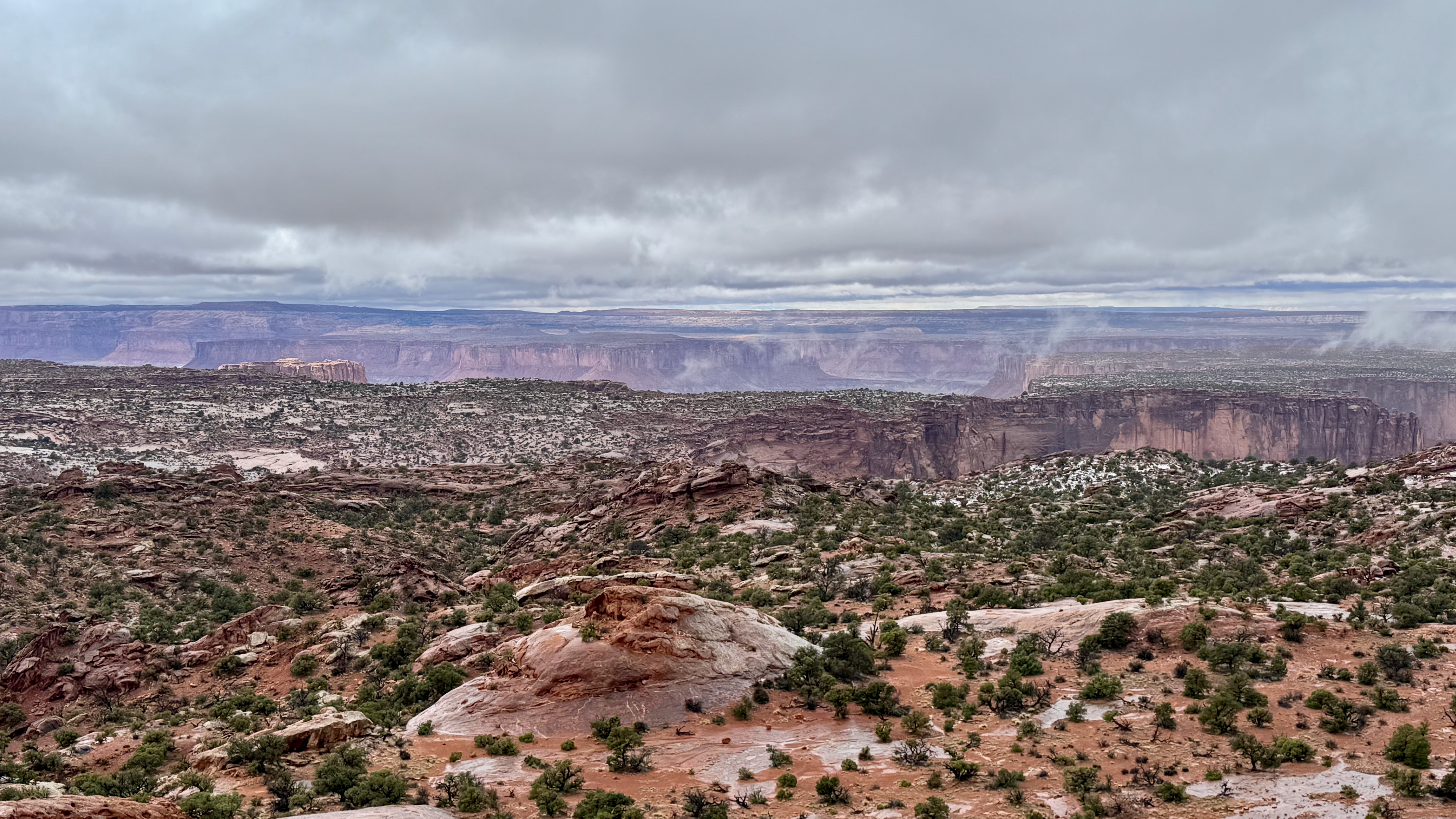
Intermittent showers (sleet in the morning, 37 degrees) cast a shroud. After three days content with short walks, I was compelled to hike up Upheaval Dome, the single most amazing sight of the trip. The dome is a green bulge inside a crater three miles across. From the first of two overlooks, the bulge looks like layers of rock, sliding at a slant from each other. From the second overlook, 90 degrees left, the layers don’t appear so clearly, especially in a rainy fog but the bulge appears more stark against the insides of the crater. Geologists have two theories about its formation.
One. A thick layer of salt, from the evaporation of landlocked seas, was pressed up through rock layers, forming a “salt bubble” that deformed surrounding rock. But recent research suggests that a salt bubble and overlying rock eroded away, and what remains is the “pinched off stem below the missing bubble,” NPS says. “If true, Upheaval Dome would earn the distinction of being the most deeply eroded salt structure on earth.”
Two. A meteorite slammed into what is now the Upheaval Dome, creating an unstable crater that partially collapsed. Rocks underground heaved upward to fill the void left by the impact. Erosion washed away meteorite debris, exposing rock layers once thousands of feet underground. This is the reigning theory, though proof remains elusive.
On the far south, the park road dead-ends at Grand View Point, at the top of the V above the confluence. The Colorado and the Green can’t be seen from here—plateaus and cliffs in the 2000-foot drop block the view. In the distance, another plateau blocks the view of the merge. A one-mile, out-and-back trail runs to the west for a view of the Green’s valley. Across the horizon, massive canyons carved over inconceivable time.
The next day I drove out of Moab along the Colorado (River) and then over Colorado’s (state) Douglas Mountains, snow-capped from the previous day’s rain. Highway 139 would take me to Rangely. I had spent the night here in 2009, on a bike ride from Salt Lake City to Boulder, Colorado. This day, driving a tiny piece of that route in reverse, I wondered: Who was that guy, cycling a hundred miles a day through a desert in July?
Back then I had gazed the white hills of Dinosaur National Monument on my left as I rode by. This afternoon I drove into the park. The find here is bones from the Jurassic, 150 million years ago. They emerged from the side of an eroding hill in 1909, spied by Earl Douglass, a paleontologist from the Carnegie Museum in Pittsburgh. Douglass’s team excavated most of the hillside but left a big slab in the hands of the government. Woodrow Wilson proclaimed the national monument in 1915; the Park Service constructed a building around the slab in 1958. Children, and the rest of us, can touch the bones of these sauropods, the order of dinosaurs that look like the logo for Sinclair gasoline, whose refinery is in nearby Wyoming, where those reptiles also roamed before turning into petroleum.
As I walked across the parking lot to the exhibit hall, two people were digging through a torn-up section of new pavement. Seems that when the original road was built 68 years ago, the engineers covered over more bones. Last year, when the road was repaved, Park Service people discovered some. So here were paleontologists on their knees with a scoop sorting dirt. We talked about their work and the stress on the monument from Trump’s hiring freeze. Several employees had left, and the seasonal staff was down. Not ideal for protecting our assets.
The park spans east into Colorado, wrapping around the Green River. Its sites include petroglyphs, credited to the Fremont people who lived in the area from about 300 to 1300 CE. As the literature notes, these were prosperous folks, with spare time to do more than the activities of survival.
Rabbit hole ahead. In the 1820s William Ashley’s fur trappers traversed the Green and traded with tribes. Butch Cassidy (nee Robert LeRoy Parker, 1866, in central Utah to English Mormon-immigrant parents) hung out here, becoming friends with Herb Bassett, who supplied him. Bassett’s daughters, Ann and Josie (born 1874) became paramours of Cassidy’s Hole-in-the-Wall Gang in the 1890s. Josie, married five times and divorced four, built a cabin within what is now Dinosaur in 1913. During Prohibition she sold moonshine and in the late 1930s was twice tried for cattle rustling; both trials ended in hung juries. She lived here, at times with son Crawford and his children, until 1963 when she slipped on ice and broke her hip. She died in 1964. Her somewhat restored cabin is on the National Register of Historic Places; the outline here is not on the plaque.
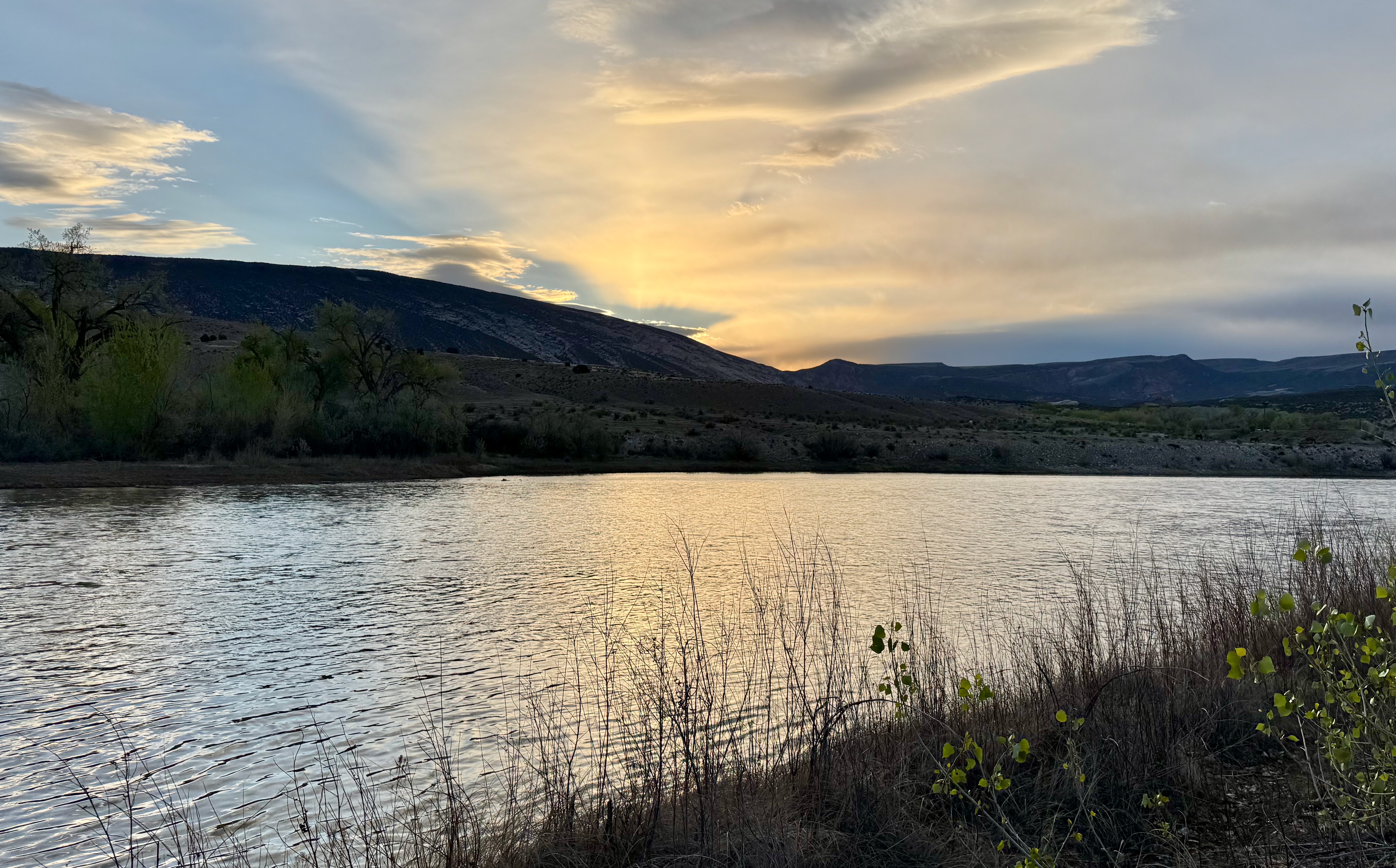
This was to be my last night camping, a few feet from the Green. I went to bed in the shadow of the dinosaurs, mulling my insignificance.
From Dinosaur I drove north on US-191 through Flaming Gorge at the horizontal Utah border to the town of Green River, Wyoming. At the Sweetwater County Historical Museum, I walked through pioneer displays typical of county museums across the continent. Like the one in Columbus, New Mexico, this one has a notorious chapter: the white riot that resulted in the murder of, officially, 51 Chinese workers beginning on September 2, 1885. A pair of Chinese and a pair of whites got in a fight in a coal mine. That evening 150 men marched to Chinatown and told its residents to leave within the hour. When the Chinese didn’t move fast enough, the whites began shooting and burning. Grover Cleveland called in the army. Three years earlier, Congress had passed the Chinese Exclusion Act, banning immigration.
Most people, especially those who run museums, respect scholarship and memory more than myth. In Trumpian Wyoming (he got 75 percent of the 16,819 votes cast in Sweetwater County), Green River has retained this history. The museum grants due prominence to John Wesley Powell for launching his expeditions down the Colorado from here in 1869 and 1971. It also sells a book, first published in 1886, about the Chinese massacre.
Twenty miles west I stopped at Little America, a traveler’s extravaganza in the middle of nowhere. It was established a century ago by a guy who’d slept outdoors in a sub-zero snowstorm while herding sheep near the Lincoln Highway, later upgraded to US-30, now I-80. Stephen Mack Covey, his story goes, built a modest refuge on the spot, naming it for Admiral Byrd’s 1929 camp on Antarctica. After a fire in 1948, Covey rebuilt it into a complex with 150 rooms in colonial-style rows, a huge restaurant and dozens of gas pumps. When my dad drove us across Wyoming in 1970, we stayed here. I was hoping to do so again.
But the hotel closed last fall, converted into an RV camp. According to the Cowboy State Daily, the owner had difficulty obtaining financing to renovate and went in a modern direction: servicing the people who bring their homes with them. (Those who want hotels can find more to do in Green River or Rock Springs.) I got coffee in the massive gift shop and expressed my condolences to the late-middle-aged lady at the register. She told me she’d been the hotel manager for 20 years until its closing but was grateful she still had a job.
I became fascinated with Wyoming not from biking and hiking in Yellowstone, which is its own world, but from a 2021 car trip over South Pass, and then from two books I read the following year: the section Rising from the Plains in John McPhee’s opus Annals of the Former World, and Mark Spragg’s Where Rivers Change Direction, essays about growing up on a dude ranch in the shadow of Yellowstone. McPhee spends time with David Love, at the time retired after 35 years with the U.S. Geological Survey. Gripping is McPhee’s account of Love’s parents, true pioneers who raised David on a ranch in Riverton. Spragg goes deeply but elliptically around my rhetorical question: Why would anyone live on a plain 7000 feet above sea level, where there are no trees and the wind never ceases?
To wit: Out of Little America, I turned northwest into a cold front that began pushing my van around like a dory at sea (okay, an exaggeration). The snow fell in waves as I approached Kemmerer, considering whether to pull into the last hotel before a 7100-foot pass, semis throwing slush on my windshield that turned to ice. A harrowing hour later at Bear Lake in Utah, the front had passed, re-covering the mountains white, above drab browns and muted sage set against ever-changing clouds. I am watching the earth erode, here beyond the hundredth meridian.
The next afternoon I went off I-84 in search of the previous era when our government built concentration camps for those considered Other. Under Franklin Roosevelt’s Executive Order 9066, more than 120,000 Japanese Americans, two-thirds of them citizens, were exiled to desolate camps for more than three years during the Second World War. The Idaho camp was Minidoka. Also known as Camp Hunt, it had 640 tarpaper-and-wood barracks set on 1.5 square miles, surrounded by guard towers and barbed wire, with armed soldiers circulating inside the camp. At peak Minidoka held 9,397 prisoners, 13,000 individuals in total.
It’s now a National Historical Site under the Park Service, originally the Minidoka Internment National Monument proclaimed by Bill Clinton. It’s also a ruin, its buildings long ago repurposed and the land it sat on distributed to returning mostly White GIs. There are plaques and concrete foundations and a replica guard tower constructed in 2014 by Boise State University students. The visitor center is a renovated warehouse that was part of the camp. But it’s open only May to September three days a week. Hmmm. Is it seasonal because Congress doesn’t adequately fund our government? (Yes.) Or because it conflicts with Donald Trump’s executive order directing NPS to erase “any signs or information that are negative about either past or living Americans . . .”? (I don’t know.) Or because Idaho doesn’t get many tourists when school is in? (Two nearby national monuments, Hagerman Fossil Beds in Idaho and Fossil Butte in Wyoming, are staffed year-round.) Off-season I found no sign in front of the center, nothing from the road to indicate it’s the site’s headquarters.
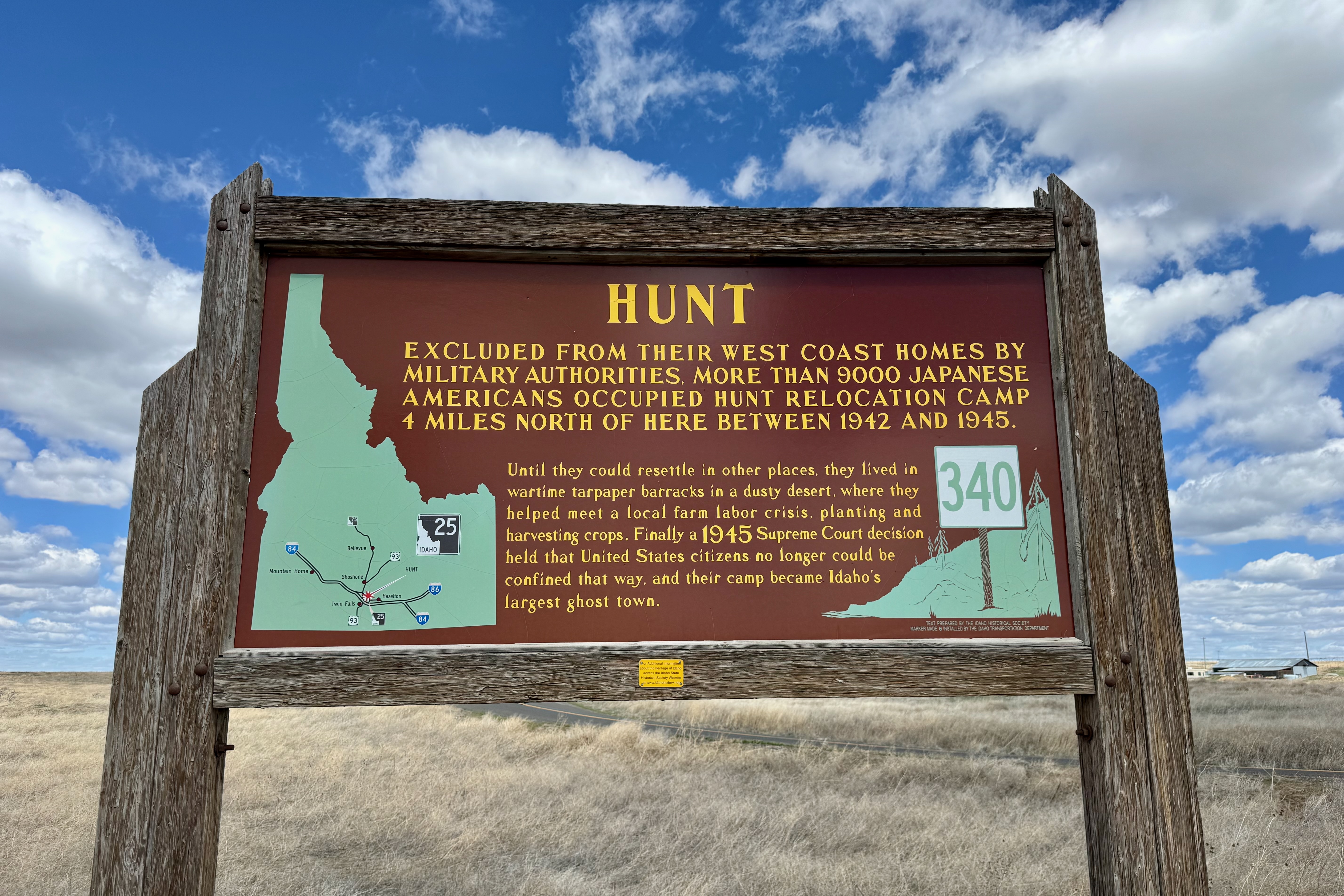
And why does Idaho have a road sign, along a busier highway three miles away, informing us that “a 1945 Supreme Court decision held that the United States citizens no longer could be confined”—without mentioning the 1944 Korematsu decision that upheld the incarceration of Japanese Americans from the West Coast? In dissent, Justice Robert Jackson called the exclusion order “the legalization of racism” that violated the Fourteenth Amendment.
In 1976 Gerald Ford terminated 9066. “We have learned from the tragedy of that long-ago experience forever to treasure liberty and justice for each individual American, and resolve that this kind of action shall never again be repeated.” A 1983 congressional commission concluded: “The broad historical causes which shaped these decisions were race prejudice, war hysteria and a failure of political leadership.” Congress authorized, and the United States paid $1.6 billion to descendants of the internees in the 1980s. In issuing another apology in 1992, George H.W. Bush said: “No nation can fully understand itself or find its place in the world if it does not look with clear eyes at all the glories and disgraces of its past.”
In 2025 the Trump administration rushed to build for-profit concentration camps, as Stephen Miller, White House deputy staff director, promised during the 2024 campaign. By its count, ICE “detentions” rose from 39,000 to 69,000 people during Trump’s first year, while the number of camp inspections fell from 102 in 2024 to 54 in 2025.
In June 2026 the Supreme Court, in Mullin v. Doe, allowed the administration to expel Haitians, Syrians and others granted asylum under Temporary Protected Status created by Congress, and it barred the courts from evaluating whether the administration was following the steps required by law. Which is to say: The court denied due process. In the face of Trump’s contention that Haitians in Ohio were eating dogs and cats and that unlawful immigrants were “poisoning the blood of our country,” Justice Alito wrote for the 6-3 majority: “None of the cited statements by either the President or the Secretary [of Homeland Security] was overtly racial, and in substance all expressed policy views that could rest on race-neutral justifications.” In the days after Mullin v. Doe was released, Immigration and Customs Enforcement rounded up thousands of long-settled people.
The facts of Minidoka and other Park Service-administered destinations is on npshistory.com, a site founded in 2013. It’s become a vital resource as the Trump administration erases the history the National Park Service has curated that it doesn’t like. That’s why I’ve linked the parks and monuments cited in this narrative not to NPS pages. I no longer trust them.
It was time to finish my journey on the final stage of the Oregon Trail. In the 1840s and 50s, the overlanders arrived in what is now the state of Oregon by way of the Powder River Valley and gazed with trepidation at the snow-covered Blue Mountains. They still had 400 miles to travel, a distance that would take weeks: down the sloping Blues, then fording the tributaries of the Columbia to The Dalles, where the Gorge forced them into the river at least as far as Hood River. They probably took the Barlow toll road over the 4000-foot gap in the Cascades downslope from Mt. Hood to Oregon City, the official end of the trail. From there they traveled up the Willamette Valley, where they cultivated one the great bread baskets of North America.
I drove those 400 miles to Portland in half a day, passing semis on I-84, vapor trails in the sky, barges on the Columbia and locomotives on its edges. In early afternoon I was home with wife and dog. The overlanders on the Oregon Trail took four months to walk 2,000 miles from Independence (and other points on the Missouri River) to Oregon City. I had a leisurely drive three times that length in 38 days. We have been bequeathed technologies unimaginable to the natives who subsisted here for 20,000 years. Our standard of living is destroying a sustainable environment. But it sure is comfortable.